Sierra de la Culata
The Sierra de La Culata is a mountain range in the largest massif in Venezuela, the Cordillera de Mérida, which in turn is part of the northern extent of the Cordillera de los Andes (Andes Mountains). The Sierra la Culata includes some of the highest peaks in Venezuela, such as Pico Piedras Blancas, Pico Pan de Azúcar, and Collado del Cóndor.
| Sierra de La Culata | |
|---|---|
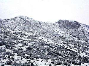 Sierra de La Culata on snowy season | |
| Highest point | |
| Peak | Pico Piedras Blancas |
| Elevation | 4,737 m (15,541 ft) |
| Coordinates | 8°59′13″N 71°15′0″W |
| Geography | |
.jpg) Sierra de La Culata | |
| Country | Venezuela |
| Region | Mérida, Trujillo |
It is located between the states of Mérida and Trujillo. Most of the lagoons are a result of the Mérida glaciation.
The Sierra La Culata National Park is a protected area within the range.
Gallery
.jpg)


gollark: Core War¿
gollark: It does all sciences except space - very slowly - and has a reasonably large mall... but only a 30MW steam power setup.
gollark: I just managed to totally kill my base's power grid by using robots!
gollark: Er, utility science, I forgotr.
gollark: I'm planning to get hightech science and some bots, then burn the place to the ground and start over with a Modular Train Future™.
See also
- Merida glaciation
- Sierra Nevada de Merida
External links
This article is issued from Wikipedia. The text is licensed under Creative Commons - Attribution - Sharealike. Additional terms may apply for the media files.