Shingave
Shingave is a village in Rahata taluka of Ahmednagar district in the Indian state of Maharashtra. It is one of the largest village by area in Rahata.
Shingave | |
|---|---|
village | |
 Shingave Location in Maharashtra, India | |
| Coordinates: 19°47′56″N 74°33′23″E | |
| Country | |
| State | Maharashtra |
| District | Ahmednagar |
| Taluka | Rahata |
| Government | |
| • Type | Panchayati raj |
| • Body | Grampanchayat |
| Population (2011) | |
| • Total | 4,258 |
| Demonym(s) | Shingavekar |
| Languages | |
| • Official | Marathi |
| Time zone | UTC+5:30 (IST) |
| PIN | 413708 |
| Telephone code | 02423 |
| Vehicle registration | MH-17 |
| Website | http://www.shingave-rahata.mahapanchayat.gov.in |
Location
Shingave is situated on the bank of Godavari river in the northern region of Ahmednagar District and Rahata taluka.[1]
Puntamba, Pimpalwadi, Sade, Rui and Wari are the nearby villages to Shingave. Shirdi, Rahata and Kopargaon are the nearby cities.
Demographics
Population
The population of Shingave village is 4258 as of the 2011 census. Males constitute 2194 whereas females constitute 2064.[2]
Literacy
Literacy rate of village is 67.52% which is below national and state average rates .
Economy
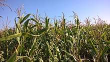
Agriculture is a backbone of a village. Most of the people are farmers who are engaged farming and allied work like Dairy farming, Goat farming. Many youths are employed in near city Shirdi. Some people are marginal workers.
Following table shows crops cultivated in village.
| Type | Crops |
|---|---|
| Kharif | Pearl millet, Sorghum, Maize, Soybean |
| Rabi | Wheat, Gram |
| Cash Crops | Sugarcane, Onion |
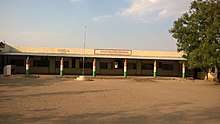
Education
Shingave has three Zilla Parishad primary schools and one secondary school.
- Primary schools
- ZP School (Central location)
- ZP School (West region)
- ZP School (East region)
- Secondary school
- Shringeshwar Madhyamik Vidyalaya
Transport
Road
Shingave is connected to nearby cities and villages by state highway (SH 36) and other rural roads. State highway connects Shingave to Kopargaon, Puntamba and Shrirampur, rural roads to Pimpalwadi, Rui, Wari and Shirdi.
Air
Shirdi Airport is the nearest airport to village at distance of 25 km.
Gallery
- Around Village
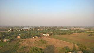 Aerial View of village
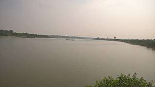 Godavari river as seen from the Maruti temple in village.
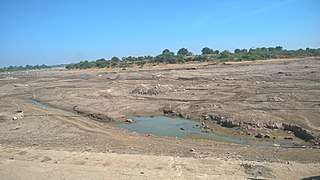 Dried river in February as seen from Ghat
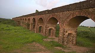 Abandoned Structure once used for Water Irrigation System
See also
References
- MRSAC. Village Map (PDF) (Map). Rahata Taluka: Maharashtra Remote Sensing Applications Centre. Retrieved 24 November 2018.
- "Census of India 2011". Census of India. Registrar General & Census Commissioner. Retrieved 4 August 2017.