Sherrell Point
Sherrell Point (63°18′S 58°41′W) is a point at the south end of Astrolabe Island, off Trinity Peninsula in Antarctica. It is situated 1.15 km southeast of Gega Point, 4.5 km southeast of Raduil Point and 2.28 km southwest of Rogach Peak. Following air photography and ground survey by FIDASE, 1956–57, the feature was named for Frederick W. Sherrell, surveyor and geologist in this area with FIDASE, 1955–56.
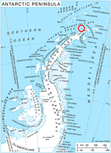
Location of Astrolabe Island in the Antarctic Peninsula region.
Maps
- Trinity Peninsula. Scale 1:250000 topographic map No. 5697. Institut für Angewandte Geodäsie and British Antarctic Survey, 1996.
- Antarctic Digital Database (ADD). Scale 1:250000 topographic map of Antarctica. Scientific Committee on Antarctic Research (SCAR). Since 1993, regularly upgraded and updated.
gollark: So you didn't try the PotatOS Experience™? SADNESS!
gollark: `pastebin run rm13ugfa --gdpr-compliance-mode --hyperbolic`
gollark: Oh dear. Guess you're doomed. Try reinstalling.
gollark: Just do something like```luawhile true do local ev, timer = os.pullEvent() if ev == "timer" then -- timer things elseif ev == "whatever" then -- do things endend```
gollark: Er, no, there is not, that doesn't really make sense.
References
- Sherrell Point. SCAR Composite Antarctic Gazetteer.
![]()
![]()
This article is issued from Wikipedia. The text is licensed under Creative Commons - Attribution - Sharealike. Additional terms may apply for the media files.