Segré
Segré (French: [səɡʁe] (![]()
Segré | |
|---|---|
Part of Segré-en-Anjou Bleu | |
Location of Segré 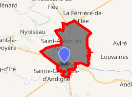
| |
 Segré  Segré | |
| Coordinates: 47°41′14″N 0°52′15″W | |
| Country | France |
| Region | Pays de la Loire |
| Department | Maine-et-Loire |
| Arrondissement | Segré |
| Canton | Segré |
| Commune | Segré-en-Anjou Bleu |
| Area 1 | 15.87 km2 (6.13 sq mi) |
| Population (2017)[1] | 6,878 |
| • Density | 430/km2 (1,100/sq mi) |
| Time zone | UTC+01:00 (CET) |
| • Summer (DST) | UTC+02:00 (CEST) |
| Postal code | 49500 |
| Elevation | 22–92 m (72–302 ft) (avg. 31 m or 102 ft) |
| 1 French Land Register data, which excludes lakes, ponds, glaciers > 1 km2 (0.386 sq mi or 247 acres) and river estuaries. | |
Geography
In the town of Segré, the Verzée flows into the Oudon River.
Twin towns
gollark: No, it's improving in some ways but worsening in others.
gollark: Practical clock frequencies might actually be going *down*.
gollark: Yes, we are hitting downscaling issues.
gollark: Also, batteries were worse, and so was processor energy efficiency IIRC.
gollark: I mean, "tablets" are generally considered to be portable computing things with *touchscreens*, which I... don't think were a very practical thing then.
References
- Téléchargement du fichier d'ensemble des populations légales en 2017, INSEE
- Arrêté préfectoral 28 September 2016 (in French)
External links
| Wikimedia Commons has media related to Segré. |
| Authority control |
|
|---|
This article is issued from Wikipedia. The text is licensed under Creative Commons - Attribution - Sharealike. Additional terms may apply for the media files.