Schinder (mountain)
Schinder is a mountain on the border of Bavaria, Germany and Tyrol, Austria. There are two summits, one called Austrian Schinder or Trausnitzberg (1808 m), and the other slightly lower one called Bavarian Schinder (1796 m). The former sits right on the border of Bavaria and Tyrol, whereas the latter is situated wholly in Bavaria.
| Schinder | |
|---|---|
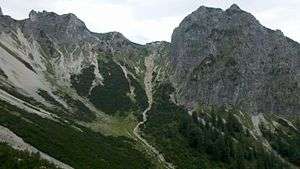
 Cirque of the Schinder with Rotkogel to the right | |
| Highest point | |
| Elevation | 1,808 m (5,932 ft) |
| Isolation | 4.6 km (2.9 mi) |
| Geography | |
| Location | Bavaria, Germany and Tyrol, Austria |
| Geology | |
| Mountain type | Main dolomite[1] |
| Climbing | |
| Easiest route | alpine hike |
Alpinism
The easiest summit access route lies on the south side and passes alp Trausnitzalm. The north face of the Schinder forms an impressive cirque for such a relatively low altitude mountain, with an ascent that leads through that cirque.
gollark: For purposes, I imagine.
gollark: Unlike certain OTHER services, YouTube uses a reasonable bitrate.
gollark: Well, modern video codecs are rather good.
gollark: No.
gollark: Why would they *not* be? It isn't like there's much particularly everyone-killing stuff likely to happen in the next few decades.
References
- Bayerisches Geologisches Landesamt, 1998, Geologische Karte von Bayern mit Erläuterungen 1:500.000 (Geological map, in German)
This article is issued from Wikipedia. The text is licensed under Creative Commons - Attribution - Sharealike. Additional terms may apply for the media files.