Saputara
Saputara is a hill station located in Sahyadris or Western Ghats. Saputara town is part of Dang district in Gujarat. It is a tourist destination.[1]
Saputara | |
|---|---|
Hill station | |
 View of Saputara Hill station | |
 Saputara Location in Gujarat | |
| Coordinates: 20°34′47″N 73°44′48″E | |
| Country | India |
| State | Gujarat |
| District | Dang District |
| Elevation | 1,000 m (3,000 ft) |
| Population (2011) | |
| • Total | 2,968 |
| • Density | 3,151/km2 (8,160/sq mi) |
| Languages | |
| • Official | Gujarati |
| Time zone | UTC+5:30 (IST) |
| PIN | 394720 |
| Telephone code | +02631 |
| Vehicle registration | GJ 30 |
| Website | http://www.saputara.net/ |
Demographics
As per 2011 census of India, the Saputara notified area has population of 2,968 of which 1,031 are males while 1,937 are females.[2] The literacy rate of Saputara is 87.4%. Thus Saputara has higher literacy rate compared to 75.2% of The Dangs district. The male literacy rate is 89.73% and the female literacy rate is 86.29% in Saputara.[3]
Transportation
Saputara lies on National Highway 953 which connects to Songadh in Gujarat and Pimpalgaon Baswant in Maharashtra.[4]
Gallery
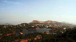
.jpg) View of Saputara Hill station
View of Saputara Hill station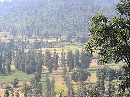 Valley view
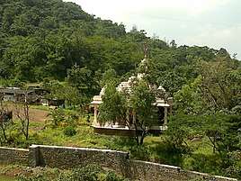 Nageshwar Temple
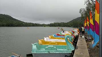 Boats at Saputara Lake
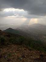 A View from Sunset Point Saputara Hill Station
gollark: Sure. But it's functionally equivalent to just mapping each 5 bits to a letter.
gollark: If gods can do gzip or something, this would also increase link efficiency a lot because English is *not* information-dense.
gollark: That's not binary search, that's just encoding letters as binary.
gollark: Binary search will just get you numbers.
gollark: Not binary search, just send ASCII over the link.
See also
References
- "Saputara Hill station". Dangs district administration website. Retrieved 13 June 2018.
- "Saputara Population Census 2011". Retrieved 13 June 2018.
- "Saputara demographics". Retrieved 13 June 2018.
- "New highways notification dated 13th June, 2014" (PDF). The Gazette of India - Ministry of Road Transport and Highways. 13 June 2014. Retrieved 13 June 2018.
| Wikimedia Commons has media related to Saputara. |
This article is issued from Wikipedia. The text is licensed under Creative Commons - Attribution - Sharealike. Additional terms may apply for the media files.