Santa María, Catamarca
Santa María is a city in the province of Catamarca, Argentina. It has about 17,030 inhabitants per the 2010 census [INDEC], and is the head town of the department of the same name.
Santa María | |
|---|---|
Belgrano Plaza, Santa María. | |
Flag  Coat of arms | |
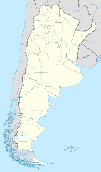
 Santa María Location of Santa María in Argentina | |
| Coordinates: 26°41′S 66°2′W | |
| Country | |
| Province | |
| Department | Santa María |
| Population (2010 census) | |
| • Total | 17,030 |
| Time zone | UTC-3 (ART) |
| CPA base | K4139 |
| Dialing code | +54 3838 |
Climate
| Climate data for Santa María, Catamarca (1904–1950, extremes 1904–1950 and 1976–1986) | |||||||||||||
|---|---|---|---|---|---|---|---|---|---|---|---|---|---|
| Month | Jan | Feb | Mar | Apr | May | Jun | Jul | Aug | Sep | Oct | Nov | Dec | Year |
| Record high °C (°F) | 41.3 (106.3) |
42.5 (108.5) |
38.4 (101.1) |
36.0 (96.8) |
33.3 (91.9) |
31.7 (89.1) |
29.6 (85.3) |
36.5 (97.7) |
36.7 (98.1) |
38.9 (102.0) |
39.0 (102.2) |
40.6 (105.1) |
42.5 (108.5) |
| Average high °C (°F) | 30.2 (86.4) |
29.5 (85.1) |
28.2 (82.8) |
25.8 (78.4) |
22.3 (72.1) |
19.8 (67.6) |
19.8 (67.6) |
22.6 (72.7) |
25.5 (77.9) |
27.4 (81.3) |
29.5 (85.1) |
30.4 (86.7) |
25.9 (78.6) |
| Daily mean °C (°F) | 21.8 (71.2) |
21.3 (70.3) |
19.8 (67.6) |
16.5 (61.7) |
12.7 (54.9) |
10.0 (50.0) |
9.6 (49.3) |
11.9 (53.4) |
15.1 (59.2) |
17.6 (63.7) |
20.1 (68.2) |
21.4 (70.5) |
16.5 (61.7) |
| Average low °C (°F) | 13.4 (56.1) |
13.1 (55.6) |
11.4 (52.5) |
7.2 (45.0) |
3.0 (37.4) |
0.1 (32.2) |
−0.6 (30.9) |
1.2 (34.2) |
4.7 (40.5) |
7.8 (46.0) |
10.7 (51.3) |
12.4 (54.3) |
7.0 (44.6) |
| Record low °C (°F) | 4.5 (40.1) |
5.0 (41.0) |
−0.3 (31.5) |
−5.0 (23.0) |
−7.5 (18.5) |
−11.6 (11.1) |
−10.0 (14.0) |
−11.5 (11.3) |
−7.5 (18.5) |
−4.0 (24.8) |
−3.6 (25.5) |
−1.5 (29.3) |
−11.6 (11.1) |
| Average precipitation mm (inches) | 44.1 (1.74) |
33.1 (1.30) |
22.3 (0.88) |
2.0 (0.08) |
1.0 (0.04) |
0.4 (0.02) |
1.6 (0.06) |
1.0 (0.04) |
0.4 (0.02) |
10.7 (0.42) |
17.5 (0.69) |
36.7 (1.44) |
170.8 (6.72) |
| Average relative humidity (%) | 33 | 37 | 53 | 55 | 50 | 51 | 49 | 50 | 52 | 50 | 40 | 39 | 47 |
| Source: Secretaria de Mineria[1] | |||||||||||||
gollark: It was Rph, they're not on here.
gollark: https://media.discordapp.net/attachments/277889706178641931/767039003379367946/20201017_165709.jpg?width=562&height=422
gollark: Correction, *Minecraft* as init.
gollark: I saw someone somehow use java as their init, but I think that was some kind of convoluted joke.
gollark: > play of the game 2020`punch tree`?
References
- "Provincia de Catamarca - Clima Y Meteorologia: Datos Meteorologicos Y Pluviometicos" (in Spanish). Secretaria de Mineria de la Nacion (Argentina). Archived from the original on August 8, 2014. Retrieved September 10, 2015.
- Municipal information: Municipal Affairs Federal Institute (IFAM), Municipal Affairs Secretariat, Ministry of Interior, Argentina. (in Spanish)
This article is issued from Wikipedia. The text is licensed under Creative Commons - Attribution - Sharealike. Additional terms may apply for the media files.