Sandspit, New Zealand
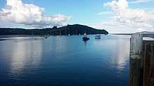
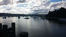
Sandspit is a northern coastal suburb of Auckland, in New Zealand. It is on the Mahurangi Peninsula about 65 kilometres north of the city centre. It has experienced substantial increases in property values during the first two decades of the 21st century.[1]
Sandspit | |
|---|---|
Suburb | |
| Country | New Zealand |
| Local authority | Auckland Council |
| Electoral ward | Rodney Ward |
| Wellsford | Matakana | Omaha |
| Warkworth |
|
(Kawau Island) |
| Puhoi | Snells Beach |
Ferries run several times a day from Sandspit to Kawau Island.[2] Ferry service between Sandspit and Kawau first started in 1934, with a boat which was (possibly later) called Nancibel[l].[3][4] In the 1950s, Nancibel was replaced by Mairie and Kawau Isle.[5]
Brick Bay, which is adjacent to Sandspit, has a sculpture trail along a two-kilometre path through native bush, fields and ponds.[6]
Demographics
| Year | Pop. | ±% p.a. |
|---|---|---|
| 2006 | 801 | — |
| 2013 | 879 | +1.34% |
| 2018 | 969 | +1.97% |
| Source: [7] | ||


The statistical area of Sandspit, at 22 square kilometres, is larger than the suburb. It had a population of 969 at the 2018 New Zealand census, an increase of 90 people (10.2%) since the 2013 census, and an increase of 168 people (21.0%) since the 2006 census. There were 393 households. There were 486 males and 483 females, giving a sex ratio of 1.01 males per female. The median age was 54.7 years, with 123 people (12.7%) aged under 15 years, 114 (11.8%) aged 15 to 29, 426 (44.0%) aged 30 to 64, and 306 (31.6%) aged 65 or older.
Ethnicities were 95.4% European/Pākehā, 3.4% Māori, 2.2% Pacific peoples, 1.2% Asian, and 2.2% other ethnicities (totals add to more than 100% since people could identify with multiple ethnicities).
The proportion of people born overseas was 26.9%, compared with 27.1% nationally.
Although some people objected to giving their religion, 57.0% had no religion, 33.7% were Christian, and 1.9% had other religions.
Of those at least 15 years old, 234 (27.7%) people had a bachelor or higher degree, and 96 (11.3%) people had no formal qualifications. The median income was $37,300. The employment status of those at least 15 was that 363 (42.9%) people were employed full-time, 165 (19.5%) were part-time, and 9 (1.1%) were unemployed.[7]
Notes
- Catherine Smith and Daria Kuprienko (12 January 2020). "Who's top dog in real estate's million-dollar club?". New Zealand Herald.CS1 maint: uses authors parameter (link)
- "Sandspit – Kawau". Kawau Cruises. Retrieved 24 May 2020.
- Edwards, Bob (Winter 2017). "Ken Ricketts" (PDF). Kookaburra. pp. 64–65.
- ""Nancibel" in New Dress". Rodney & Otamatea Times, Waitemata and Kaipara Gazette. 10 December 1941. p. 4.
- "A Brief history of the Kawau ferry transport 1946 -1990". Waitematawoodys.com. 1 December 2013.
- Nicholls, Jenny (21 December 2019). "Sculpture parks – coming to a paddock near you". Noted.
- "Statistical area 1 dataset for 2018 Census". Statistics New Zealand. March 2020. Sandspit (111400). 2018 Census place summary: Sandspit