Sandeid
Sandeid is a village in Vindafjord municipality in Rogaland county, Norway. The village is located at the head of the Sandeidfjorden, about 7 kilometres (4.3 mi) northwest of the village of Vikedal and about 11 kilometres (6.8 mi) south of the village of Ølensjøen. The 0.61-square-kilometre (150-acre) village has a population (2013) of 622, giving the village a population density of 1,020 inhabitants per square kilometre (2,600/sq mi).[1]
Sandeid | |
|---|---|
Village | |
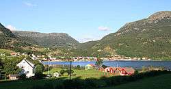
 View of the village | |
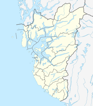
 Sandeid Location in Rogaland county  Sandeid Sandeid (Norway) | |
| Coordinates: 59°32′39″N 05°51′44″E | |
| Country | Norway |
| Region | Western Norway |
| County | Rogaland |
| District | Ryfylke |
| Municipality | Vindafjord |
| Area | |
| • Total | 0.61 km2 (0.24 sq mi) |
| Elevation | 11 m (36 ft) |
| Population (2013)[1] | |
| • Total | 622 |
| • Density | 1,020/km2 (2,600/sq mi) |
| Time zone | UTC+01:00 (CET) |
| • Summer (DST) | UTC+02:00 (CEST) |
| Post Code | 5585 Sandeid |
Sandeid has a slaughterhouse, sand pits, and a cement factory. Sandeid Church is also located in the village.[3]
History
The village was the administrative centre for many years. It was the administrative centre of the old municipality of Sandeid from 1923 until 1965 when Sandeid was merged into Vindafjord municipality. The village was then the administrative centre of the municipality of Vindafjord from 1965 until 2006. In 2006, the municipality of Ølen was merged with Vindafjord. Since 2006, the administrative centre of Vindafjord has been the village of Ølensjøen in what was previously Ølen municipality.[3]
References
- Statistisk sentralbyrå (1 January 2013). "Urban settlements. Population and area, by municipality".
- "Sandeid, Vindafjord (Rogaland)" (in Norwegian). yr.no. Retrieved 2015-06-19.
- Store norske leksikon. "Sandeid – tettsted" (in Norwegian). Retrieved 2015-06-19.