San Benito River
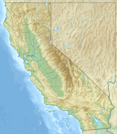
The San Benito River is a river on the Central Coast of California. From its headwaters southeast of Santa Rita Peak in the Diablo Range, it flows northwest between the Diablo Range and the Gabilan Range, traveling for about 109 miles (175 km),[3] past Hollister, California, where it turns west into the San Juan Valley where it follows the northern hills before turning north to its confluence with the Pajaro River, about 15 miles (24 km) upstream from the river's outlet in Monterey Bay. The San Benito River is longer than the Pajaro River and it drains more area, but it has proportionally lower flows. The streambed is usually dry during the summer, as the Central Coast receives almost all of its rain during the winter.
| San Benito River San Juan River [1] | |
|---|---|
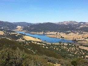 The San Benito River valley and Hernandez Reservoir | |
 Mouth of San Benito River | |
| Location | |
| Country | United States |
| State | California |
| Region | San Benito County |
| Physical characteristics | |
| Source | |
| • location | southeast of Santa Rita Peak in the Diablo Range. |
| • coordinates | 36°19′58″N 120°35′03″W[2] |
| • elevation | 4,920 ft (1,500 m) |
| Mouth | mouth |
• location | at its confluence with the Pajaro River. |
• coordinates | 36°53′47″N 121°33′46″W[2] |
• elevation | 115 ft (35 m) |
| Length | 109 mi (175 km) |
Father Juan Crespí, in his expedition in 1772, named the river in honor of San Benedicto (Saint Benedict), the patron saint of the married, and "Benito" is the contraction of this name.
The surrounding mineral soils come from serpentine which has naturally occurring asbestos. Mining of asbestos, sand, gravel and gypsum has and continues to degrade the watershed. In portions of the river you will find homeless camps, trash, concrete, evidence of mining damage, and the occasional fossil. California's official state gem, Benitoite, was first discovered in the headwaters of the river. The mineral is named after its county of origin, San Benito County.
The river is dammed near its headwaters at Hernandez Reservoir, which was built in the early 1960s for irrigation supply and flood control. The lake has a storage capacity of 18,000 acre⋅ft (22,000,000 m3).
See also
- Clear Creek (San Benito River)
- List of rivers of California
References
- Gudde, Erwin G. California Place Names: A Geographical Dictionary. Berkeley, California: University of California Press, 1949; p.298
- U.S. Geological Survey Geographic Names Information System: San Benito River
- U.S. Geological Survey. National Hydrography Dataset high-resolution flowline data. The National Map, accessed March 15, 2011