San Antonio de Los Altos
San Antonio de los Altos is a suburban town, capital of Los Salias Municipality, Miranda State, Venezuela with a population of 75,000 in 2001. The town got his name referring to the patron saint of the region and the mountainous area.
San Antonio de Los Altos | |
|---|---|
 | |
 Flag  Seal | |
.svg.png) San Antonio de Los Altos | |
| Coordinates: 10°22′28″N 66°58′01″W | |
| Country | |
| State | Miranda |
| Municipality | Los Salias Municipality |
| Founded | 1 May 1683 |
| Area | |
| • Total | 51 km2 (20 sq mi) |
| Elevation | 1,600 m (5,200 ft) |
| Population | |
| • Total | 74,422 |
| • Demonym | Sanantoñero/a |
| Time zone | VST |
| Postal code | 1204 |
| Area code(s) | 0212 |
| Climate | Cfb |
Geography
It covers an area of about 55 km2 and has an average altitude of 1,300 meters above sea level.
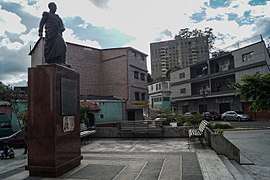
Landmarks
gollark: ···
gollark: Depends what the simulator is doing.
gollark: Obviously, with all those extra dimensions, they're a string theorist.
gollark: Here is a meme. There will be no more memes until a later time.
gollark: I mean, technically you're all just being simulated on my laptop, for purposes.
This article is issued from Wikipedia. The text is licensed under Creative Commons - Attribution - Sharealike. Additional terms may apply for the media files.