Saline River (Michigan)
The Saline River is a 45.6-mile-long (73.4 km)[2] river in southeastern Michigan in the United States. A tributary of the River Raisin, it originates in Washtenaw County; flows through the cities of Saline and Milan, where it enters Monroe County; then joins the River Raisin at the village of Dundee. Although named after the city of Saline, which was once famous for its salt springs, the Saline River is not at all salty.
| Saline River | |
|---|---|
.jpg) Saline River in Saline, Michigan | |
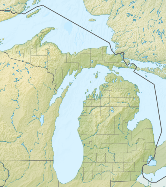 Location within the state of Michigan | |
| Location | |
| Country | United States |
| Physical characteristics | |
| Source | |
| • location | Washtenaw County |
| • coordinates | 42.1575°N 83.9396°W[1] |
| Mouth | |
• location | River Raisin, Michigan |
• coordinates | 41.9753°N 83.6127°W |
| Length | 45.6 mi (73.4 km) |
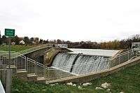
Saline River Dam, Saline
See also
References
- "Saline River". Geographic Names Information System. United States Geological Survey.
- U.S. Geological Survey. National Hydrography Dataset high-resolution flowline data. The National Map, accessed May 19, 2011
| Wikimedia Commons has media related to Saline River (Michigan). |
This article is issued from Wikipedia. The text is licensed under Creative Commons - Attribution - Sharealike. Additional terms may apply for the media files.