Salinas barrio-pueblo
Salinas barrio-pueblo is a barrio and the administrative center (seat) of Salinas, a municipality of Puerto Rico. Its population in 2010 was 2,453.[1][4][5][6]
Salinas barrio-pueblo Barrio Pueblo Salinas | |
|---|---|
Municipality Seat[1] | |
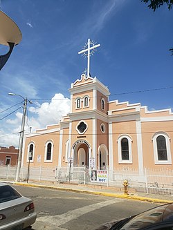 Nuestra Señora de la Monserrate Catholic church in Salinas | |
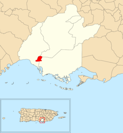 Location of Salinas barrio-pueblo within the municipality of Salinas shown in red | |
 Salinas barrio-pueblo Location of Puerto Rico | |
| Coordinates: 17°58′45″N 66°17′48″W[2] | |
| Commonwealth | |
| Municipality | |
| Area | |
| • Total | 0.46 sq mi (1.2 km2) |
| • Land | 0.46 sq mi (1.2 km2) |
| • Water | 0 sq mi (0 km2) |
| Elevation | 23 ft (7 m) |
| Population (2010) | |
| • Total | 2,453 |
| • Density | 5,332.6/sq mi (2,058.9/km2) |
| Source: 2010 Census | |
| Time zone | UTC−4 (AST) |
As was customary in Spain, in Puerto Rico, the municipality has a barrio called pueblo which contains a central plaza, the municipal buildings (city hall), and a Catholic church. Fiestas patronales (patron saint festivals) are held in the central plaza every year.[7][8]
History
The United States took control of Puerto Rico from Spain in the aftermath of the Spanish-American War under the terms of the Treaty of Paris of 1898. In 1899, the United States conducted its first census of Puerto Rico finding that the population of Pueblo barrio was 1,192.[9]
The central plaza history
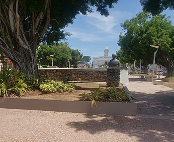
The central plaza, or square, is a place for official and unofficial recreational events and a place where people can gather and socialize from dusk to dawn. The Laws of the Indies, Spanish law, which regulated life in Puerto Rico in the early 19th century, stated the plaza's purpose was for "the parties" (celebrations, festivities) (Spanish: a propósito para las fiestas), and that the square should be proportionally large enough for the number of neighbors (Spanish: grandeza proporcionada al número de vecinos). These Spanish regulations also stated that the streets nearby should be comfortable portals for passersby, protecting them from the elements: sun and rain.[7]
Gallery
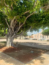 Plaza in Salinas
See also
References
- Puerto Rico:2010:population and housing unit counts.pdf (PDF). U.S. Dept. of Commerce, Economics and Statistics Administration, U.S. Census Bureau. 2010.
- "US Gazetteer 2019". US Census. US Government.
- U.S. Geological Survey Geographic Names Information System: Salinas barrio-pueblo
- Picó, Rafael; Buitrago de Santiago, Zayda; Berrios, Hector H. Nueva geografía de Puerto Rico: física, económica, y social, por Rafael Picó. Con la colaboración de Zayda Buitrago de Santiago y Héctor H. Berrios. San Juan Editorial Universitaria, Universidad de Puerto Rico,1969.
- Gwillim Law (20 May 2015). Administrative Subdivisions of Countries: A Comprehensive World Reference, 1900 through 1998. McFarland. p. 300. ISBN 978-1-4766-0447-3. Retrieved 25 December 2018.
- "US Census Barrio-Pueblo definition". factfinder.com. US Census. Archived from the original on 13 May 2017. Retrieved 5 January 2019.
- Santullano, Luis A. (10 March 2019). Mirada al Caribe. 54. Colegio de Mexico. pp. 75–78. doi:10.2307/j.ctvbcd2vs.12. JSTOR j.ctvbcd2vs.12.
- Pariser, Harry S. (2003). Explore Puerto Rico, Fifth Edition. San Francisco: Manatee Press. pp. 52–55. Retrieved 10 February 2019.
- Joseph Prentiss Sanger; Henry Gannett; Walter Francis Willcox (1900). Informe sobre el censo de Puerto Rico, 1899, United States. War Dept. Porto Rico Census Office (in Spanish). Imprenta del gobierno. p. 163.