Salamonie Lake Dam
Salamonie Dam (National ID # IN03005) is a dam in Wabash County, Indiana.
| Salamonie Dam | |
|---|---|
| Country | United States |
| Location | Wabash County, Indiana |
| Coordinates | 40°48′25″N 85°40′45″W |
| Salamonie Lake | |
|---|---|
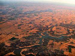 Salmonie Lake in the foreground, with the town of Huntington, Indiana to the left background | |
| Location | Wabash County, Indiana |
| Type | reservoir |
| Surface elevation | 751 feet (229 m)[1] |
The earthen and rockfill dam was constructed in 1966 by the United States Army Corps of Engineers, with a height of 133 feet and 6100 feet long at its crest.[2][3] It impounds the Salamonie River for flood control and storm water managed, is owned by the Corps of Engineers, and is operated by the Corps and the Indiana Department of Natural Resources.
The reservoir it creates, Salamonie Lake, has a normal water surface of 4.5 miles[4] and a maximum capacity of 263,600 acre-feet;[5] the total project encompasses 12,000 acres of land and water.[6] Recreation includes boating, swimming and fishing for white crappie, channel catfish, white bass, and walleye.[7] The state also operates the adjacent Salamonie River State Forest, Mt. Hope State Recreation Area, Dora New Holland State Recreation Area, Lost Bridge State Recreation Area, and Mt. Etna State Recreation Area.
References
- U.S. Geological Survey Geographic Names Information System: Salamonie Lake Dam
- http://findlakes.com/salamonie_lake_indiana_vacation.htm
- "Archived copy". Archived from the original on 2015-04-02. Retrieved 2012-08-27.CS1 maint: archived copy as title (link)
- http://findlakes.com/salamonie_lake_indiana_vacation.htm
- "Archived copy". Archived from the original on 2015-04-02. Retrieved 2012-08-27.CS1 maint: archived copy as title (link)
- http://www.lrl.usace.army.mil/Missions/CivilWorks/Recreation/Lakes/SalamonieLake.aspx
- http://www.in.gov/dnr/parklake/5262.htm