Saint-Pierre-Lavis
Saint-Pierre-Lavis is a former commune in the Seine-Maritime department in the Normandy region in northern France. On 1 January 2017, it was merged into the new commune Terres-de-Caux.[2]
Saint-Pierre-Lavis | |
|---|---|
Part of Terres-de-Caux | |
Location of Saint-Pierre-Lavis 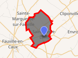
| |
 Saint-Pierre-Lavis  Saint-Pierre-Lavis | |
| Coordinates: 49°39′35″N 0°37′46″E | |
| Country | France |
| Region | Normandy |
| Department | Seine-Maritime |
| Arrondissement | Le Havre |
| Canton | Saint-Valery-en-Caux |
| Commune | Terres-de-Caux |
| Area 1 | 4.49 km2 (1.73 sq mi) |
| Population (2017)[1] | 302 |
| • Density | 67/km2 (170/sq mi) |
| Time zone | UTC+01:00 (CET) |
| • Summer (DST) | UTC+02:00 (CEST) |
| Postal code | 76640 |
| Elevation | 128–144 m (420–472 ft) (avg. 135 m or 443 ft) |
| 1 French Land Register data, which excludes lakes, ponds, glaciers > 1 km2 (0.386 sq mi or 247 acres) and river estuaries. | |
Geography
A very small farming village in the Pays de Caux, situated some 30 miles (48 km) northeast of Le Havre, at the junction of the D33, D228 and D149 roads.
Population
| 1962 | 1968 | 1975 | 1982 | 1990 | 1999 | 2006 |
|---|---|---|---|---|---|---|
| 66 | 101 | 95 | 118 | 123 | 128 | 154 |
| Starting in 1962: Population without duplicates | ||||||
Places of interest
- The church of St.Pierre, dating from the twelfth century.
- The twenty-first-century war memorial.
gollark: I have at least 20 memes about them.
gollark: It beats Intel Xeons in basically every way too.
gollark: > iirc AMD is just consumer cpus, not enterprise... have you *never* heard of Epyc?
gollark: Intel's TR equivalent would be X299 ones or whatever it is.
gollark: Like AMD EPYC ones.
References
- Téléchargement du fichier d'ensemble des populations légales en 2017, INSEE
- Arrêté préfectoral 12 September 2016 (in French)
| Wikimedia Commons has media related to Saint-Pierre-Lavis. |
| Authority control |
|
|---|
This article is issued from Wikipedia. The text is licensed under Creative Commons - Attribution - Sharealike. Additional terms may apply for the media files.