Running Water Draw
Running Water Draw is an ephemeral watercourse about 150 mi (240 km) long, heading about 24 mi (39 km) west-northwest of Clovis, New Mexico, and trending generally east-southeast, into Texas, to join Callahan Draw at the head of the White River about 9 mi (14 km) west of Floydada and 34 mi (55 km) northeast of Lubbock.[1]
| Running Water Draw | |
|---|---|
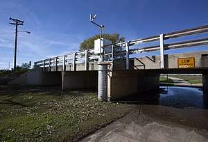 USGS gaging station in Running Water Draw | |
| Location | |
| Country | United States |
| Physical characteristics | |
| Source | |
| • location | Curry County, New Mexico |
| • elevation | 4,565 ft (1,391 m) |
| Mouth | |
• location | Floyd County, Texas |
• elevation | 3,100 ft (940 m) |
| Length | 150 mi (240 km) |
| Basin size | 1,620 sq mi (4,200 km2) |
Running Water Draw drains an area of 1,620 sq mi (4,200 km2) as it extends across Curry County, New Mexico, and Parmer, Castro, Lamb, Hale, and Floyd Counties of West Texas.[2]
References
- U.S. Geological Survey Geographic Names Information System: Running Water Draw
- Seaber, P.R., Kapinos, F.P. and Knapp, G.L. 1987. Hydrological unit maps. United States Department of the Interior, U.S. Geological Survey Water-Supply Paper 2294, p. 46.
External links
- "An Analysis of Texas Waterways". Retrieved 2006-05-04.
- U.S. Geological Survey Geographic Names Information System: Running Water Draw
- USGS Hydrologic Unit Map - State of Texas (1974)
- Photos of the high plains of the Llano Estacado of West Texas
This article is issued from Wikipedia. The text is licensed under Creative Commons - Attribution - Sharealike. Additional terms may apply for the media files.