Rueso District
Rueso (Thai: รือเสาะ, pronounced [rɯ̄ː.sɔ̀ʔ]; Malay: Raso) is a district (amphoe) of Narathiwat Province, southern Thailand.
Rueso รือเสาะ | |
|---|---|
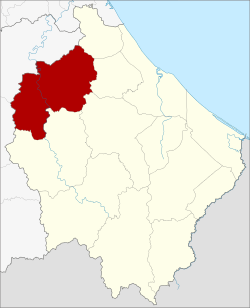 District location in Narathiwat Province | |
| Coordinates: 6°23′41″N 101°31′6″E | |
| Country | Thailand |
| Province | Narathiwat |
| Seat | Rueso Ok |
| Area | |
| • Total | 468.324 km2 (180.821 sq mi) |
| Population (2005) | |
| • Total | 62,893 |
| • Density | 134.3/km2 (348/sq mi) |
| Time zone | UTC+7 (ICT) |
| Postal code | 96180 |
| Geocode | 9606 |
Geography
Neighboring districts are (from the northeast clockwise): Bacho, Yi-ngo, Ra-ngae and Si Sakhon of Narathiwat Province; Bannang Sata and Raman of Yala Province.
History
Originally the area of the district was tambon Tamma-ngan (ตำมะหงัน) of Mueang Ra-ngae District, the present-day Ra-ngae District. In 1913 it was upgraded to Tamma-ngan Minor District (king amphoe), consisting of six sub-districts (tambons).[1] In 1917 it was renamed "Rueso".[2] On 1 October 1939 the minor district was upgraded to a full district.[3]
Administration
The district is subdivided into nine sub-districts (tambons), which are further subdivided into 71 villages (mubans). The township (thesaban tambon) Rueso covers parts of tambons Rueso and Rueso Ok. There are a further nine tambon administrative organizations (TAO).
| No. | Name | Thai name | Villages | Pop. | |
|---|---|---|---|---|---|
| 1. | Rueso | รือเสาะ | 10 | 11,831 | |
| 2. | Sawo | สาวอ | 7 | 4,214 | |
| 3. | Riang | เรียง | 8 | 5,567 | |
| 4. | Samakkhi | สามัคคี | 9 | 5,465 | |
| 5. | Batong | บาตง | 8 | 5,821 | |
| 6. | Lalo | ลาโละ | 8 | 8,656 | |
| 7. | Rueso Ok | รือเสาะออก | 5 | 9,530 | |
| 8. | Khok Sato | โคกสะตอ | 8 | 5,136 | |
| 9. | Suwari | สุวารี | 8 | 6,673 |
References
- แจ้งความกระทรวงมหาดไทย เรื่อง ตั้งกิ่งอำเภอขึ้นในเขตแขวงเมือง ๆ ระแงะ (PDF). Royal Gazette (in Thai). 30 (0 ง): 1381–1382. September 28, 1913.
- ประกาศกระทรวงมหาดไทย เรื่อง เปลี่ยนชื่ออำเภอ (PDF). Royal Gazette (in Thai). 34 (0 ก): 40–68. April 29, 1917.
- ประกาศสำนักนายกรัฐมนตรี เรื่อง ยกฐานะกิ่งอำเภอรือเสาะ ขึ้นอำเภอระแงะ จังหวัดนราธิวาส ขึ้นเป็นอำเภอ ขนานนามว่า อำเภอรือเสาะ (PDF). Royal Gazette (in Thai). 56 (0 ง): 2075. October 9, 1939.