Ruardean Hill
Ruardean Hill is a prominent hill and a village in the English county of Gloucestershire, 20 km (12 mi) west of Gloucester. It lies in the Forest of Dean, in the parish of Drybrook.
| Ruardean Hill | |
|---|---|
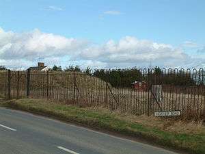
 Trig point and covered reservoir on Highview Road on Ruardean Hill | |
| Highest point | |
| Elevation | 290 m (950 ft) |
| Prominence | c. 174 m |
| Parent peak | May Hill |
| Listing | Marilyn |
| Geography | |
| Location | Gloucestershire, England |
| OS grid | SO635169 |
| Topo map | OS Landranger 162 |
The southern slopes are wooded and are part of the northern edge of the Forest of Dean. The hill forms part of a low range of hills separating the River Severn from the River Wye. The hill's summit is the highest point in the Forest of Dean. A mostly friendly community, there is a local post office and village shop in neighbouring Ruardean Woodside. The village and surrounding areas are well served by Ruardean Hill Sports and Social Club.
Nearest places
gollark: ±44%.
gollark: 2023.
gollark: The inability to factor things out a lot is among my least favourite Rust things.
gollark: Oh, plausibly.
gollark: My reactors are mostly just automatically designed as needed, though.
This article is issued from Wikipedia. The text is licensed under Creative Commons - Attribution - Sharealike. Additional terms may apply for the media files.