Rous County

Rous County is one of the 141 Cadastral divisions of New South Wales. It is located at the north-east tip of the state. It is bordered on the north by the border with Queensland and on the south by the Richmond River. It contains Lismore, Byron Bay and Murwillumbah.

Rous
New South Wales
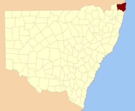
Location in New South Wales
Lands administrative divisions around Rous:
Merivale (Qld) Ward (Qld) Pacific Ocean
Buller Rous Pacific Ocean
Drake Richmond Pacific Ocean

Rous County was named in honour of Admiral Henry John Rous (1795-1877).[1]

Parishes within this county

A full list of parishes found within this county; their current LGA and mapping coordinates to the approximate centre of each location is as follows:

ParishLGACoordinates
BabyilKyogle Shire28°37′54″S 152°45′04″E
BallinaBallina Shire28°49′54″S 153°33′04″E
BerwickTweed Shire28°13′54″S 153°25′04″E
BexhillCity of Lismore28°45′54″S 153°22′04″E
BillinudgelTweed Shire28°30′54″S 153°30′04″E
BingalBallina Shire28°56′54″S 153°28′04″E
BlakebrookCity of Lismore28°45′54″S 153°16′04″E
BoorabeeCity of Lismore28°39′54″S 153°05′04″E
BroadwaterCity of Lismore29°00′54″S 153°24′04″E
BrunswickByron Shire28°35′54″S 153°31′04″E
BungabbeeCity of Lismore28°43′54″S 153°08′04″E
BurrellKyogle Shire28°23′54″S 153°15′04″E
ByronByron Shire28°39′54″S 153°32′04″E
ChillinghamKyogle Shire28°16′54″S 153°13′04″E
ClunesCity of Lismore28°40′54″S 153°25′04″E
CondongTweed Shire28°19′54″S 153°27′04″E
CorakiCity of Lismore29°00′54″S 153°19′04″E
CougalKyogle Shire28°22′54″S 152°57′04″E
CudgenTweed Shire28°16′54″S 153°33′04″E
DunbibleTweed Shire28°22′54″S 153°23′04″E
DunoonCity of Lismore28°39′54″S 153°19′04″E
DyraabaKyogle Shire28°47′54″S 152°47′04″E
East GundurimbaCity of Lismore28°51′54″S 153°18′04″E
EttrickKyogle Shire28°34′54″S 152°52′04″E
Fairy MountKyogle Shire28°33′54″S 153°03′04″E
FindonKyogle Shire28°22′54″S 152°51′04″E
GenevaKyogle Shire28°36′54″S 152°57′04″E
GooninbarKyogle Shire28°29′54″S 153°16′04″E
Hanging RockCity of Lismore28°31′54″S 153°08′04″E
JasperByron Shire28°36′54″S 153°26′04″E
JiggiCity of Lismore28°36′54″S 153°08′04″E
KunghurTweed Shire28°27′54″S 153°12′04″E
KynnumboonTweed Shire28°16′54″S 153°20′04″E
Kyogle ShireRichmond Valley Council28°45′54″S 153°00′04″E
LangwellKyogle Shire28°38′54″S 152°51′04″E
LismoreCity of Lismore28°49′54″S 153°23′04″E
LoadstoneKyogle Shire28°25′54″S 152°57′04″E
MeerschaumBallina Shire28°53′54″S 153°24′04″E
MooballTweed Shire28°24′54″S 153°29′04″E
MullumbimbyByron Shire28°31′54″S 153°26′04″E
MummulgumKyogle Shire28°52′54″S 152°47′04″E
MurwillumbahTweed Shire28°19′54″S 153°17′04″E
NewrybarBallina Shire28°44′54″S 153°33′04″E
NimbinCity of Lismore28°37′54″S 153°14′04″E
North CasinoRichmond Valley Council28°46′54″S 153°04′04″E
North CodringtonCity of Lismore28°55′54″S 153°15′04″E
North LismoreCity of Lismore28°44′54″S 153°18′04″E
NullumTweed Shire28°26′54″S 153°22′04″E
PimlicoBallina Shire28°53′54″S 153°30′04″E
QueebunKyogle Shire28°44′54″S 152°51′04″E
RoseberryKyogle Shire28°29′54″S 152°52′04″E
RunnymedeKyogle Shire28°39′54″S 153°02′04″E
RunnymedeKyogle Shire28°40′54″S 153°00′04″E
SherwoodKyogle Shire28°28′54″S 152°46′04″E
South GundurimbaCity of Lismore28°51′54″S 153°13′04″E
South LismoreCity of Lismore28°48′54″S 153°15′04″E
StrathedenKyogle Shire28°44′54″S 152°57′04″E
TeraniaCity of Lismore28°33′54″S 153°15′04″E
TerranoraTweed Shire28°12′54″S 153°30′04″E
TevenByron Shire28°45′54″S 153°32′04″E
TomkiRichmond Valley Council28°49′54″S 153°08′04″E
ToolondTweed Shire28°31′54″S 153°21′04″E
ToonumbarKyogle Shire28°32′54″S 152°46′04″E
TuckombilBallina Shire28°49′54″S 153°28′04″E
TuckurimbaCity of Lismore28°55′54″S 153°19′04″E
TunstallCity of Lismore28°41′54″S 153°14′04″E
TyalgumTweed Shire28°22′54″S 153°09′04″E
TygalgahTweed Shire28°18′54″S 153°25′04″E
UnumgarKyogle Shire28°22′54″S 152°45′04″E
WarrazambilKyogle Shire28°29′54″S 153°04′04″E
Whian WhianCity of Lismore28°35′54″S 153°20′04″E
WiangareeKyogle Shire28°33′54″S 153°00′04″E
WollumbinTweed Shire28°22′54″S 153°19′04″E
WorendoKyogle Shire28°22′54″S 153°04′04″E
WyndhamKyogle Shire28°30′54″S 152°56′04″E

Dunoon dam proposal

The Council, which is the authority responsible for the water supply for most of the Ballina, Byron, Lismore and Richmond Valley council areas, published its draft water strategy in June 2020, which includes a 50-gigalitre (1.8×10⁹ cu ft) dam at Dunoon about 20 kilometres (12 mi) north of Lismore. The council has been aware of Indigenous concerns since the matter was first considered in the 1990s, and was committed to working with local communities to mitigate concerns. An impact assessment of the site had identified various artefacts and burial sites in the area.[2]

References

  1. "Rous". Geographical Names Register (GNR) of NSW. Geographical Names Board of New South Wales. Retrieved 3 August 2013.
  2. MacKenzie, Bruce (19 June 2020). "Indigenous heritage sites could be underwater if new dam is built on New South Wales north coast". ABC News. Australian Broadcasting Corporation. Retrieved 5 July 2020.
This article is issued from Wikipedia. The text is licensed under Creative Commons - Attribution - Sharealike. Additional terms may apply for the media files.