Roullours
Roullours is a former commune in the Calvados department in the Normandy region in northwestern France. On 1 January 2016, it was merged into the new commune of Vire-Normandie.[2]
Roullours | |
|---|---|
Part of Vire-Normandie | |
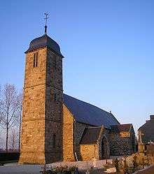 Saint Martin | |
Location of Roullours 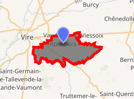
| |
 Roullours  Roullours | |
| Coordinates: 48°50′00″N 0°50′19″W | |
| Country | France |
| Region | Normandy |
| Department | Calvados |
| Arrondissement | Vire |
| Canton | Vire |
| Commune | Vire-Normandie |
| Area 1 | 13.15 km2 (5.08 sq mi) |
| Population (2017)[1] | 811 |
| • Density | 62/km2 (160/sq mi) |
| Time zone | UTC+01:00 (CET) |
| • Summer (DST) | UTC+02:00 (CEST) |
| Postal code | 14500 |
| Elevation | 169–308 m (554–1,010 ft) (avg. 312 m or 1,024 ft) |
| 1 French Land Register data, which excludes lakes, ponds, glaciers > 1 km2 (0.386 sq mi or 247 acres) and river estuaries. | |
Population
| Year | Pop. | ±% |
|---|---|---|
| 1962 | 545 | — |
| 1968 | 502 | −7.9% |
| 1975 | 520 | +3.6% |
| 1982 | 555 | +6.7% |
| 1990 | 674 | +21.4% |
| 1999 | 769 | +14.1% |
| 2008 | 859 | +11.7% |
gollark: What is this "MOT"?
gollark: ... is that an <:illum:531316942443642880> on there?
gollark: How do you derive the rules and what do you mean by "branches on the picture"?
gollark: I don't know how to actually implement the thing it says about identifying things uniquely by "a sequence of numbers which says where to turn at each intersection", since it seems like you'd need a way to convert them into a unique/canonical form for that to actually work.
gollark: I looked at that, yes.
See also
References
- Téléchargement du fichier d'ensemble des populations légales en 2017, INSEE
- Arrêté préfectoral 31 December 2015 (in French)
| Wikimedia Commons has media related to Roullours. |
| Authority control |
|
|---|
This article is issued from Wikipedia. The text is licensed under Creative Commons - Attribution - Sharealike. Additional terms may apply for the media files.