Roter Kogel
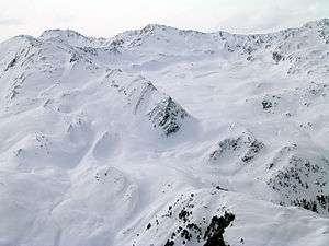
The Roter Kogel is a mountain, 2,832 m (AA), in the Stubai Alps in the Austrian state of Tyrol.
| Roter Kogel | |
|---|---|
 | |
| Highest point | |
| Elevation | 2,832 m (9,291 ft) |
| Isolation | 0.63 km (0.39 mi) |
| Coordinates | 47°08′00″N 11°10′0″E |
| Geography | |
| Location | Tyrol, Austria |
| Parent range | Stubai Alps |
It lies on a ridge that runs from the Hohe Villerspitze over the Lüsener Villerspitze (3,027 m (AA)) northwards as far as the Fotscher Windegg (2,577 m (AA)). West of this chain lies the Lüsener Valley and the village of Praxmar, a starting point for an ascent of the Roter Kogel. East of the Roter Kogels stretches the valley of Fotscher Tal, where there are two other bases: the Alpengasthof Bergheim Fotsch (1,464 m (AA)) and the Potsdamer Hut. This ascent up the eastern side is also a popular ski tour in winter.
Literature
- Heinrich und Walter Klier, Alpenvereinsführer Stubaier Alpen, Bergverlag Rudolf Rother, München 1988. ISBN 3-7633-1252-8
gollark: It's compiled *to bytecode*.
gollark: Like the osmarks.tk firefox crasher (I think that got patched).
gollark: Yes, that is true for all pages.
gollark: γρεεκ ρεαδερς ἀρε θε κοολεστ.
gollark: λυρικλυ ἰσ δυμβ.
This article is issued from Wikipedia. The text is licensed under Creative Commons - Attribution - Sharealike. Additional terms may apply for the media files.