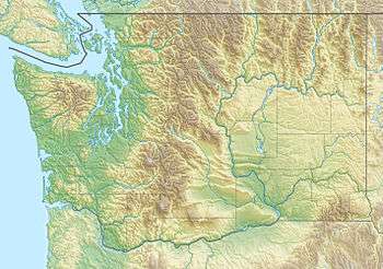
Roche Harbor Airport
Roche Harbor Airport (FAA LID: WA09) is a private airport located one nautical mile (2 km) northeast of the central business district of Roche Harbor, in San Juan County, Washington, United States.[1] It was formerly a public use airport (FAA ID: 9S1).[2] The 9S1 location identifier has been reassigned to Four Winds Airport in Celina, Texas.[3]
Roche Harbor Airport | |||||||||||
|---|---|---|---|---|---|---|---|---|---|---|---|
| Summary | |||||||||||
| Airport type | Private | ||||||||||
| Owner | Roche Harbor Airport Inc. | ||||||||||
| Serves | Roche Harbor, Washington | ||||||||||
| Elevation AMSL | 100 ft / 30 m | ||||||||||
| Coordinates | 48°36′44″N 123°08′19″W | ||||||||||
| Map | |||||||||||
 WA09 Location of airport in Washington | |||||||||||
| Runways | |||||||||||
| |||||||||||
Facilities
Roche Harbor Airport resides at elevation of 100 feet (30 m) above mean sea level. It has one runway designated 7/25 with an asphalt surface measuring 3,593 by 30 feet (1,095 x 9 m).[1]
Airline and destinations
| Airlines | Destinations |
|---|---|
| San Juan Airlines | Anacortes, Bellingham |
gollark: cease MESSAGE DELETION
gollark: ?
gollark: It's just... why would you do it this way? I'm not very good at programming stuff, but sometimes I see something and think "seriously, why did they do this, I could probably do a better job".
gollark: It does a ton of requests to http://192.168.1.1/cgi/json-req containing (no joke) HTML-form-encoded JSON which appears to be encoding some sort of RPC messages which do stuff to "XPath" objects.
gollark: I think mine has some horrible Angular-based UI with an utterly eldritch API.
See also
References
- FAA Airport Master Record for WA09 (Form 5010 PDF). Federal Aviation Administration. Effective November 15, 2012.
- "Economic Profile: Roche Harbor Airport (9S1)" (PDF). Washington State Department of Transportation. 2001.
- FAA Airport Master Record for 9S1 (Form 5010 PDF). Federal Aviation Administration, Effective 26 April 2018.
External links
- Roche Harbor Airport at WSDOT Airport Directory
- Roche Harbor Airport Web Cam
- Aerial image as of July 1990 from USGS The National Map
- Resources for this airport:
- FAA airport information for WA09
- AirNav airport information for WA09
- FlightAware airport information and live flight tracker
- SkyVector aeronautical chart for WA09
This article is issued from Wikipedia. The text is licensed under Creative Commons - Attribution - Sharealike. Additional terms may apply for the media files.