Rocha, Moca, Puerto Rico
Rocha is a barrio in the municipality of Moca, Puerto Rico. Its population in 2010 was 4,004.[3][4][5]
Rocha | |
|---|---|
Barrio | |
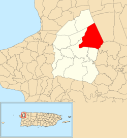 Location of Rocha within the municipality of Moca shown in red | |
 Rocha Location of Puerto Rico | |
| Coordinates: 18°24′03″N 67°03′03″W[1] | |
| Commonwealth | |
| Municipality | |
| Area | |
| • Total | 7.13 sq mi (18.5 km2) |
| • Land | 7.13 sq mi (18.5 km2) |
| • Water | 0 sq mi (0 km2) |
| Elevation | 873 ft (266 m) |
| Population (2010) | |
| • Total | 4,004 |
| • Density | 561.6/sq mi (216.8/km2) |
| Source: 2010 Census | |
| Time zone | UTC−4 (AST) |
History
The United States took control of Puerto Rico from Spain in the aftermath of the Spanish-American War under the terms of the Treaty of Paris of 1898. In 1899, the United States conducted its first census of Puerto Rico finding that the population of Rocha barrio was 902.[6]
Río Culebrinas flooding
In late May 2019, barrio Rocha and multiple areas in various municipalities suffered flooding, felled trees, landslides and closed highways when Río Culebrinas flooded.[7]
gollark: If I had immersive engineering we would have bauxite. I didn't add it, though.
gollark: Nope.
gollark: I'm tempted to just recipetweak zinc to aluminium or something somehow.
gollark: Maybe if I obliterate all land for kilometres around with turtles they'll find zinc!
gollark: You know, I saw a self-replicating turtle program on the CC forums...
See also
References
- "US Gazetteer 2019". US Census. US Government.
- U.S. Geological Survey Geographic Names Information System: Rocha barrio
- Picó, Rafael; Buitrago de Santiago, Zayda; Berrios, Hector H. Nueva geografía de Puerto Rico: física, económica, y social, por Rafael Picó. Con la colaboración de Zayda Buitrago de Santiago y Héctor H. Berrios. San Juan Editorial Universitaria, Universidad de Puerto Rico,1969.
- Gwillim Law (20 May 2015). Administrative Subdivisions of Countries: A Comprehensive World Reference, 1900 through 1998. McFarland. p. 300. ISBN 978-1-4766-0447-3. Retrieved 25 December 2018.
- Puerto Rico:2010:population and housing unit counts.pdf (PDF). U.S. Dept. of Commerce, Economics and Statistics Administration, U.S. Census Bureau. 2010.
- Joseph Prentiss Sanger; Henry Gannett; Walter Francis Willcox (1900). Informe sobre el censo de Puerto Rico, 1899, United States. War Dept. Porto Rico Census Office (in Spanish). Imprenta del gobierno. p. 160.
- "Árboles caídos, ríos crecidos y carreteras cerradas en el oeste por las lluvias". Primera Hora (in Spanish). 29 May 2019.
This article is issued from Wikipedia. The text is licensed under Creative Commons - Attribution - Sharealike. Additional terms may apply for the media files.