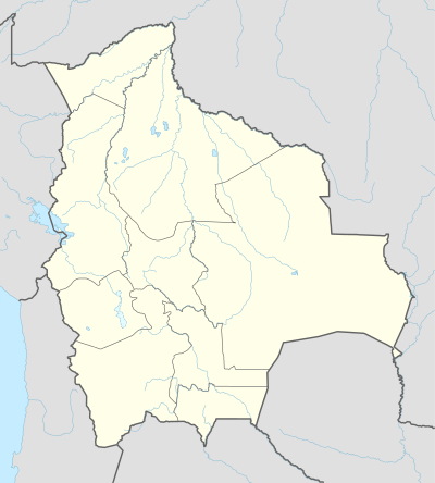
Roboré
It is home to the Regimiento De Infanteria 15 Junin Roboré[3] of the Bolivian Army.
Roboré | |
|---|---|
Town | |
 Flag  Seal | |
 Roboré Location of San Ignacio in Bolivia | |
| Coordinates: 18°20′S 59°45′W | |
| Country | |
| Department | |
| Province | Chiquitos |
| Municipality | Roboré |
| Elevation | 856 ft (261 m) |
| Population (2012) | |
| • Total | 10,098 |
| Time zone | UTC-4 (BST) |
| Sources: Google Maps[1] OSM[2] | |
Roboré is a town in eastern Bolivia.
Climate
| Climate data for Robore | |||||||||||||
|---|---|---|---|---|---|---|---|---|---|---|---|---|---|
| Month | Jan | Feb | Mar | Apr | May | Jun | Jul | Aug | Sep | Oct | Nov | Dec | Year |
| Record high °C (°F) | 37.2 (99.0) |
37.2 (99.0) |
38.3 (100.9) |
36.1 (97.0) |
35.6 (96.1) |
33.9 (93.0) |
35.0 (95.0) |
36.7 (98.1) |
39.4 (102.9) |
40.6 (105.1) |
40.0 (104.0) |
37.8 (100.0) |
40.6 (105.1) |
| Average high °C (°F) | 32.8 (91.0) |
33.3 (91.9) |
32.2 (90.0) |
30.6 (87.1) |
26.7 (80.1) |
29.4 (84.9) |
27.8 (82.0) |
29.4 (84.9) |
31.7 (89.1) |
33.3 (91.9) |
32.2 (90.0) |
32.2 (90.0) |
31.1 (88.0) |
| Daily mean °C (°F) | 28.5 (83.3) |
28.0 (82.4) |
27.3 (81.1) |
25.5 (77.9) |
23.6 (74.5) |
22.0 (71.6) |
22.0 (71.6) |
24.6 (76.3) |
26.8 (80.2) |
29.2 (84.6) |
28.2 (82.8) |
28.7 (83.7) |
26.2 (79.2) |
| Average low °C (°F) | 22.2 (72.0) |
21.1 (70.0) |
20.0 (68.0) |
16.7 (62.1) |
14.4 (57.9) |
15.6 (60.1) |
14.4 (57.9) |
15.6 (60.1) |
18.3 (64.9) |
20.0 (68.0) |
20.6 (69.1) |
22.2 (72.0) |
18.3 (64.9) |
| Record low °C (°F) | 17.2 (63.0) |
9.4 (48.9) |
12.2 (54.0) |
2.2 (36.0) |
0.0 (32.0) |
2.2 (36.0) |
4.4 (39.9) |
3.9 (39.0) |
5.0 (41.0) |
10.0 (50.0) |
12.8 (55.0) |
14.4 (57.9) |
0.0 (32.0) |
| Average precipitation mm (inches) | 152.8 (6.02) |
128.3 (5.05) |
130.6 (5.14) |
92.1 (3.63) |
76.5 (3.01) |
50.2 (1.98) |
23.2 (0.91) |
34.9 (1.37) |
51.7 (2.04) |
94.7 (3.73) |
123.6 (4.87) |
137.2 (5.40) |
1,095.7 (43.14) |
| Average precipitation days (≥ 1.0 mm) | 9.5 | 8.0 | 8.9 | 7.4 | 8.0 | 4.3 | 2.8 | 2.5 | 2.8 | 8.9 | 8.2 | 9.6 | 81.0 |
| Average relative humidity (%) | 73 | 71 | 74 | 76 | 77 | 68 | 68 | 64 | 61 | 61 | 69 | 69 | 69 |
| Source: Deutscher Wetterdienst[4] | |||||||||||||
gollark: All we can do is watch as our ridiculously fast computers and networks grow ever slower with stacked layers of ridiculous hacks, as dependencies accrete and bizarre increasingly convoluted security problems come with them.
gollark: It could have been controlled, once. But now it's impossible to replace the decades upon decades of legacy design decisions.
gollark: Also networking.
gollark: All of civilization relies on the incomprehensible nested abstractions of software.
gollark: It's already too late.
References
- Roboré Google Maps
- OpenStreetMap Roboré
- 15th Infantry Regiment YouTube
- "Klimatafel von Roboré; Prov. Santa Cruz / Bolivien" (PDF). Baseline climate means (1961-1990) from stations all over the world (in German). Deutscher Wetterdienst. Retrieved 27 January 2016.
This article is issued from Wikipedia. The text is licensed under Creative Commons - Attribution - Sharealike. Additional terms may apply for the media files.