Robin Hood Way
The Robin Hood Way is a waymarked long-distance footpath in the Midlands of England.[1]
| Robin Hood Way | |
|---|---|
 Robin Hood Way | |
| Length | 168 km (104 mi) |
| Location | Nottinghamshire |
| Use | Hiking |
| Elevation | |
| Highest point | 157 metres (515 ft) |
| Hiking details | |
| Season | All year Round |
| Sights | Sherwood Forest |
Length
The Robin Hood Way runs for 168 kilometres (104 mi).
Route
The Robin Hood way commemorates the famous folklore figure Robin Hood and starts from Nottingham Castle running to Edwinstowe.
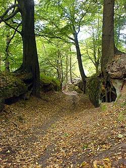
Its passes through Sherwood Forest taking in Clumber Park, Farnsfield, Greasley, Kimberley, Rainworth, Creswell Crags, Kirton and Bothamsall.
gollark: Why even have power supplies when you could just use 18648916489142 really low-voltage batteries in series?
gollark: This was disabled some time ago. Although I seem to have it back now.
gollark: Reject "ferrites", embrace the RUST PROGRAMMING LANGUAGE AND PURE SAFETY.
gollark: Suuuuuuuuure.
gollark: This sort of thing seems like more of a vague moral signalling statement than actual advice.
References
- "Robin Hood Way". ldwa.org.uk. Retrieved 7 July 2013.
External links
| Wikimedia Commons has media related to Robin Hood Way. |
This article is issued from Wikipedia. The text is licensed under Creative Commons - Attribution - Sharealike. Additional terms may apply for the media files.