River Ellen
The Ellen is a river in the English county of Cumbria, flowing from Skiddaw in the Northern Fells to the Solway Firth at Maryport. It was historically in the county of Cumberland. It is approximately 25 miles (40.2 km) miles in length.
| River Ellen | |
|---|---|
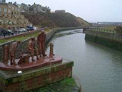 The mouth of the River Ellen at Maryport harbour. | |
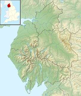 Location of the mouth within Cumbria | |
| Location | |
| Country | United Kingdom |
| Constituent country | England |
| Physical characteristics | |
| Source | Skiddaw massif |
| • location | Keswick, Northern Fells |
| Mouth | Maryport harbour |
• location | Maryport, Solway Firth |
• coordinates | 54.7145°N 3.5013°W |
| Length | 25 mi (40 km) |
| Basin features | |
| Tributaries | |
| • left | Gill Gooden |
| • right | Dash Beck |
Course
The river rises on the Skiddaw massif,[1] and runs in a generally westerly direction, passing Uldale, Ireby, Boltongate, Baggrow and Blennerhasset parish boundary and Aspatria. From there, it continues southwest (instead of more northwesterly) past Oughterside, Gilcrux, Bullgill, Crosby and Dearham, and skirts the grounds of Netherhall School before flowing into the Solway Firth at Maryport.
Fish
The river contains populations of brown trout, eels, lamprey, minnows, salmon, sea trout, and stickleback.[2][3]
Tributaries
- Dash Beck
- Gill Gooden
- Row Beck
gollark: Oh, another use: transporting items in bulk via /home and stuff.
gollark: Well, sure, in that case...
gollark: Anyway, place down disk drive + reboot isn't exactly hard with physical access anyway.
gollark: Or skynet.
gollark: Same thing, but swap cloud catcher for some random program or other.
References
- "West Cumbria Rivers Trust - Ellen". Retrieved 21 February 2015.
- "Lake District Fishing - River Ellen". Retrieved 21 February 2015.
- "West Cumbria Rivers Trust - Ellen". Retrieved 21 February 2015.
This article is issued from Wikipedia. The text is licensed under Creative Commons - Attribution - Sharealike. Additional terms may apply for the media files.