Rivadavia, Salta
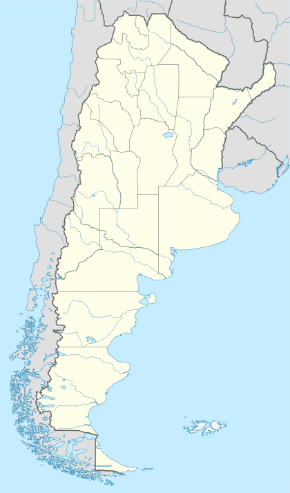
Rivadavia is a town in eastern Salta Province, Argentina in the Department of Rivadavia, 87 kilometres (54 mi) from the city of Salta.[1] It is in a low-lying region of the province.
Rivadavia | |
|---|---|
 Rivadavia Location in Argentina | |
| Coordinates: 24°11′0″S 62°53′0″W | |
| Elevation | 206 m (667 ft) |
| Population (2001) | |
| • Total | 8,108 |
| Time zone | UTC-3 (ART) |
| • Summer (DST) | UTC-2 |
| Area code(s) | +54 387 |
| Climate | BSh |
Climate
Rivadavia has a semi-arid climate according to the Köppen climate classification. Temperature extremes can be very high in the summer especially in early summer before the heaviest and most persistent rain. The highest temperature ever recorded in South America was held by Rivadavia, when it peaked at 48.9 °C (120.0 °F) on December 11, 1905.[2]
Climate details
According to the Köppen climate classification Rivadavia has a hot humid subtropical climate with significant tropical influence. The climate combines a wet summer season with a dry winter and it is classified as 'Cwa'.
However, using the Trewartha climate classification the climate is semi-arid with very hot summers and mild winters, being classified as 'BShl'.
| Climate data for Rivadavia, Argentina (1961–1990, extremes 1905–present) | |||||||||||||
|---|---|---|---|---|---|---|---|---|---|---|---|---|---|
| Month | Jan | Feb | Mar | Apr | May | Jun | Jul | Aug | Sep | Oct | Nov | Dec | Year |
| Record high °C (°F) | 44.0 (111.2) |
43.7 (110.7) |
42.0 (107.6) |
39.0 (102.2) |
37.3 (99.1) |
35.0 (95.0) |
38.0 (100.4) |
41.2 (106.2) |
43.7 (110.7) |
44.7 (112.5) |
45.3 (113.5) |
48.9 (120.0) |
48.9 (120.0) |
| Average high °C (°F) | 35.8 (96.4) |
34.4 (93.9) |
32.4 (90.3) |
28.6 (83.5) |
25.8 (78.4) |
22.7 (72.9) |
24.0 (75.2) |
27.0 (80.6) |
29.7 (85.5) |
33.2 (91.8) |
34.4 (93.9) |
35.5 (95.9) |
30.3 (86.5) |
| Daily mean °C (°F) | 28.0 (82.4) |
27.1 (80.8) |
25.5 (77.9) |
22.1 (71.8) |
19.2 (66.6) |
15.9 (60.6) |
16.0 (60.8) |
18.3 (64.9) |
21.4 (70.5) |
25.1 (77.2) |
26.6 (79.9) |
27.8 (82.0) |
22.8 (73.0) |
| Average low °C (°F) | 22.1 (71.8) |
21.5 (70.7) |
20.3 (68.5) |
17.2 (63.0) |
14.2 (57.6) |
10.8 (51.4) |
9.9 (49.8) |
11.4 (52.5) |
14.2 (57.6) |
18.0 (64.4) |
20.0 (68.0) |
21.4 (70.5) |
16.8 (62.2) |
| Record low °C (°F) | 10.1 (50.2) |
11.0 (51.8) |
8.6 (47.5) |
3.0 (37.4) |
−0.6 (30.9) |
−3.0 (26.6) |
−5.3 (22.5) |
−3.2 (26.2) |
−1.0 (30.2) |
4.0 (39.2) |
4.0 (39.2) |
10.4 (50.7) |
−5.3 (22.5) |
| Average precipitation mm (inches) | 128.1 (5.04) |
97.7 (3.85) |
91.3 (3.59) |
64.4 (2.54) |
16.7 (0.66) |
10.9 (0.43) |
4.4 (0.17) |
4.1 (0.16) |
13.6 (0.54) |
42.9 (1.69) |
76.6 (3.02) |
115.3 (4.54) |
666.0 (26.22) |
| Average precipitation days (≥ 0.1 mm) | 9 | 9 | 10 | 8 | 6 | 4 | 3 | 1 | 2 | 5 | 9 | 9 | 75 |
| Average relative humidity (%) | 66 | 66 | 72 | 78 | 75 | 73 | 66 | 58 | 55 | 54 | 62 | 65 | 66 |
| Mean monthly sunshine hours | 248 | 254 | 248 | 180 | 186 | 120 | 155 | 217 | 210 | 248 | 240 | 248 | 2,554 |
| Mean daily sunshine hours | 8 | 9 | 8 | 6 | 6 | 4 | 5 | 7 | 7 | 8 | 8 | 8 | 7 |
| Source 1: NOAA,[3] Meteo Climat (record highs and lows)[4] | |||||||||||||
| Source 2: Servicio Meteorológico Nacional (precipitation days 1961–1990, humidity 1981-1990)[5][6] Deutscher Wetterdienst (sun)[7] | |||||||||||||
References
- "Mapa de Salta (Map of Salta)" (in Spanish). Retrieved 2008-01-25.
- "Global Measured Extremes of Temperature and Precipitation". Retrieved 2008-01-25.
- "Rivadavia Climate Normals 1961–1990". National Oceanic and Atmospheric Administration. Retrieved March 29, 2015.
- "STATION Rivadavia" (in French). Météoclimat. Retrieved February 14, 2016.
- "Datos Estadisticos (Periodo 1981-1990)" (in Spanish). Servicio Meteorológico Nacional. Retrieved April 8, 2013.
- "Valores Medios de Temperature y Precipitación-Salta: Rivadavia" (in Spanish). Servicio Meteorológico Nacional. Retrieved March 29, 2015.
- "Klimatafel von Rividavia, Prov. Salta / Argentinien" (PDF). Baseline climate means (1961-1990) from stations all over the world (in German). Deutscher Wetterdienst. Retrieved February 14, 2016.