Rijnwaarden
Rijnwaarden (![]()
Rijnwaarden | |
|---|---|
Former municipality | |
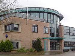 Rijnwaarden town hall | |
 Flag  Coat of arms | |
.svg.png) Location in Gelderland | |
| Coordinates: 51°52′N 6°7′E | |
| Country | Netherlands |
| Province | Gelderland |
| Municipality | Zevenaar |
| Established | 1985 |
| Area | |
| • Total | 48.08 km2 (18.56 sq mi) |
| • Land | 39.84 km2 (15.38 sq mi) |
| • Water | 8.24 km2 (3.18 sq mi) |
| Elevation | 15 m (49 ft) |
| Time zone | UTC+1 (CET) |
| • Summer (DST) | UTC+2 (CEST) |
| Postcode | 6910–6917 |
| Area code | 0316 |
| Website | www |
Population centres
Topography
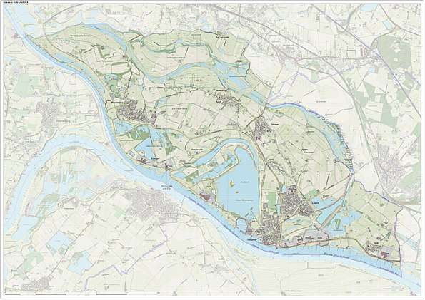
Dutch Topographic map of the former municipality of Rijnwaarden, June 2015
gollark: https://helloboi.osmarks.net/ is now pointed to the HNode™.
gollark: Or now, actually.
gollark: I can point it to the HNode™ at some point.
gollark: Kindly something something cryoapioforms dynamic DNS?
gollark: How exciting.
References
- "Kerncijfers wijken en buurten" [Key figures for neighbourhoods]. CBS Statline (in Dutch). CBS. 2 July 2013. Retrieved 12 March 2014.
- "Postcodetool for 6915AH". Actueel Hoogtebestand Nederland (in Dutch). Het Waterschapshuis. Retrieved 17 July 2014.
- "Gemeentelijke indeling op 1 januari 2018". CBS (in Dutch). Retrieved 30 November 2019.
External links

- Official website
Places adjacent to Rijnwaarden | ||||||||||
|---|---|---|---|---|---|---|---|---|---|---|
| ||||||||||
| Authority control |
|---|
This article is issued from Wikipedia. The text is licensed under Creative Commons - Attribution - Sharealike. Additional terms may apply for the media files.