Rhode Island's congressional districts
Rhode Island is divided into 2 congressional districts, each represented by a member of the United States House of Representatives. It is the least populous state in the nation to have more than one congressional district.
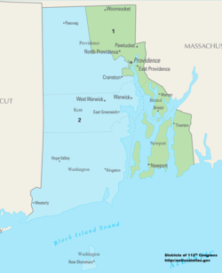
The districts are currently represented in the 116th United States Congress by 2 Democrats.
Current districts and representatives
| District | Representative | Party | CPVI | Incumbent time in office |
|---|---|---|---|---|
| 1st |  |
Democratic | D+14 | January 3, 2011 – Present |
| 2nd |  |
Democratic | D+6 | January 3, 2001 – Present |
Historical and present district boundaries
Table of United States congressional district boundary maps in the State of Rhode Island, presented chronologically.[2] All redistricting events that took place in Rhode Island between 1973 and 2013 are shown. District numbers are represented by the map fill colors.
| Year | Statewide map |
|---|---|
| 1973–1982 | 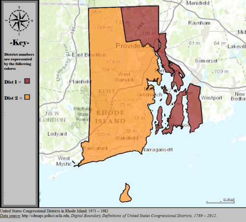 |
| 1983–1992 | 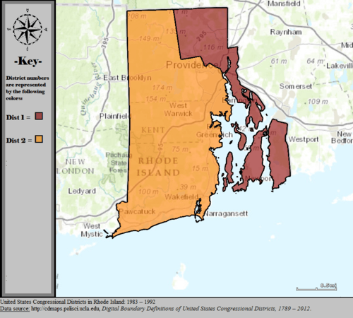 |
| 1993–2002 |  |
| 2003–2013 | 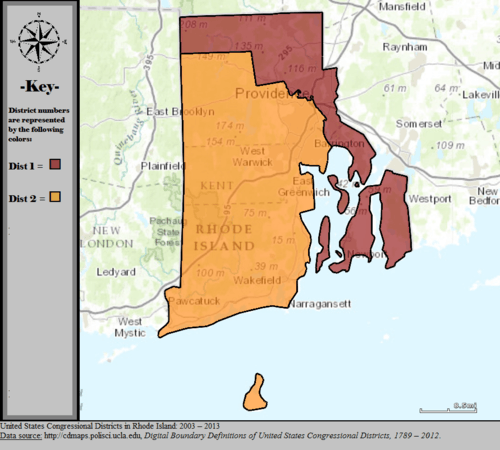 |
| Since 2013 | 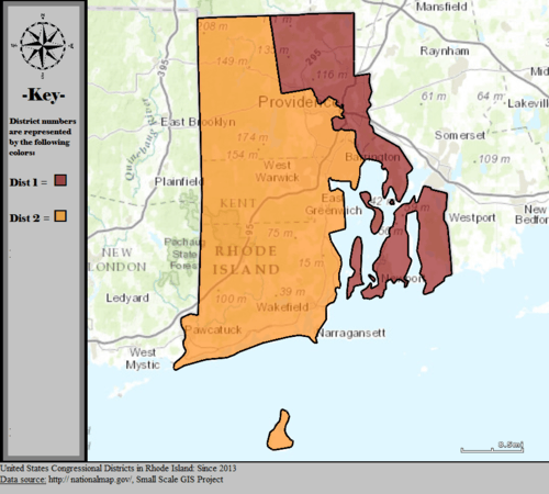 |
Obsolete districts
gollark: ↑
gollark: Truth cuboid #9 disagrees, preemptively.
gollark: ↑ Lyricly
gollark: https://media.discordapp.net/attachments/811213663150407691/921031559799259136/unknown.png
gollark: I clearly have all those skills.
References
- "The national atlas". nationalatlas.gov. Archived from the original on February 22, 2014. Retrieved February 22, 2014.
- "Digital Boundary Definitions of United States Congressional Districts, 1789–2012". Retrieved October 18, 2014.
This article is issued from Wikipedia. The text is licensed under Creative Commons - Attribution - Sharealike. Additional terms may apply for the media files.