Rangawali Dam
Rangawali Dam, is an earthfill dam on Rangawali river near Dhule but in Nandurbar district in the state of Maharashtra in India.
| Rangawali Dam | |
|---|---|
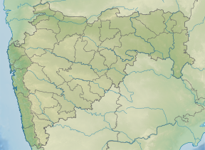 Location of Rangawali Dam in Maharashtra | |
| Official name | Rangawali Dam D01441 |
| Location | Dhule |
| Coordinates | 21.0615337°N 73.8644314°E |
| Opening date | 1982[1] |
| Owner(s) | Government of Maharashtra, India |
| Dam and spillways | |
| Type of dam | Earthfill |
| Impounds | Rangawali river |
| Height | 25.63 m (84.1 ft) |
| Length | 1,878 m (6,161 ft) |
| Dam volume | 1,289 km3 (309 cu mi) |
| Reservoir | |
| Total capacity | 12,890 km3 (3,090 cu mi) |
| Surface area | 329 km2 (127 sq mi) |
Specifications
The height of the dam above lowest foundation is 25.63 m (84.1 ft) while the length is 1,878 m (6,161 ft). The volume content is 1,289 km3 (309 cu mi) and gross storage capacity is 15,020.00 km3 (3,603.49 cu mi).[2]
Purpose
- Irrigation
gollark: Binary search time!
gollark: I mean, most modern WiFi devices can use ~5GHz now too.
gollark: Or socially pressure/shame people into complying.
gollark: You can tell people to do or not do things, which has at least *some* influence on behavior.
gollark: OR CAN YOU?
See also
- Dams in Maharashtra
- List of reservoirs and dams in India
References
- "Rangawali D01441". Retrieved March 22, 2013.
- Specifications of large dams in India
This article is issued from Wikipedia. The text is licensed under Creative Commons - Attribution - Sharealike. Additional terms may apply for the media files.