Pyeonghae
Pyeonghae is a South Korean town. It is administered as part of Uljin County in North Gyeongsang Province.
Pyeonghae 평해읍 | |
|---|---|
| Korean transcription(s) | |
| • Chosŏn'gŭl | 평해읍 |
| • Hancha | 平海邑 |
| • McCune-Reischauer | P'yŏnghae-ŭp |
| • Revised Romanization | Pyeonghae-eup |
| Coordinates: 36°43′32.18″N 129°26′29.82″E | |
| Country | |
| Province | North Gyeongsang |
| County | Uljin |
| Incorporation | 1 December 1980 |
| Area | |
| • Total | 37.16 km2 (14.35 sq mi) |
| Population | |
| • Total | 3,798 |
Name
Pyeonghae's name means "Peaceful Sea(s)". It appears in 19th-century sources as "Pingai",[1] "Pingai Harbor",[2] and "Ping-hai Harbor".[3]
Geography
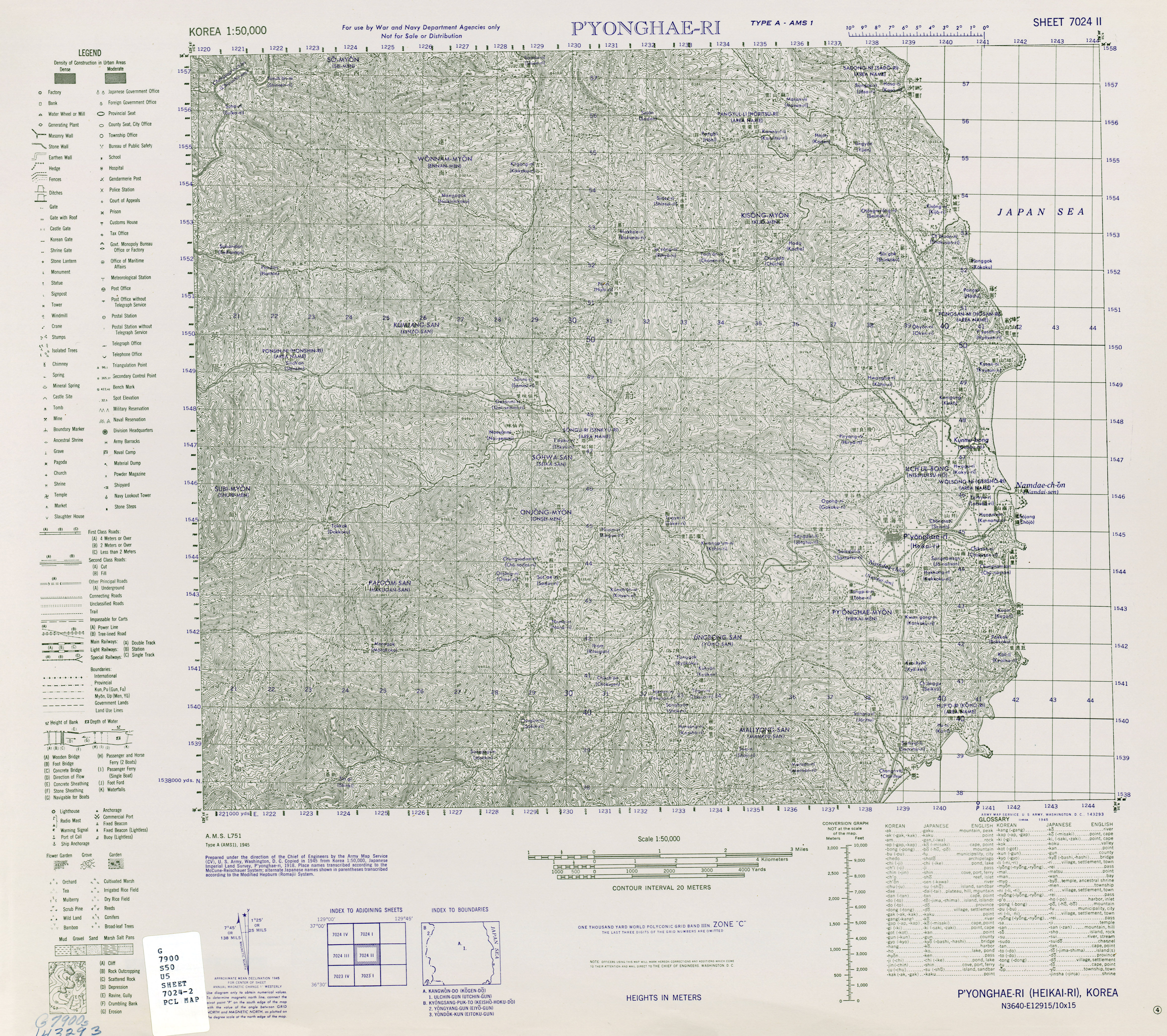
Pyeonghae lies on the north bank of the Namdae (南大川, "Southern Great River"), about a mile inland from its confluence with the Sea of Japan[4] on the eastern shore of the Korean Peninsula. Its harbor was formed by a conical island, which sheltered an anchorage in the Namdae estuary.[3]
History
During the 19th century, Pyeonghae was reckoned one of the primary harbors on Korea's eastern shore.[1]
Pyeonghae Village (Pyeonghae-ri) was officially promoted to town status on 1 December 1980.
gollark: There are similar issues in the realm of books and stuff, but the convention there is more to actually pay for them.
gollark: I… see.
gollark: It is a shame nobody's come up with a particularly good model for funding IP development which doesn't either make it artificially scarce or basically rely on goodwill.
gollark: Presumably, poor incentives to actually improve performance? Maybe their corporate structure is such that nobody can really work on crosscutting stuff like that and everyone does individual features.
gollark: Solution; swap places somehow.
See also
References
Citations
- EB (1878), p. 391.
- EB (1878), p. 390.
- King (1861), p. 381.
- US Army (1945).
Bibliography
- , Encyclopædia Britannica, 9th ed., Vol. VI, New York: Charles Scribner's Sons, 1878, pp. 390–394.
- "P'yonghae-Ri", Korea 1:50,000, Ser. L751, Washington: Army Map Service, 1945.
- King, John W. (1861), The China Pilot: The Coasts of China, Korea, and Tartary..., London: J.D. Potter for the Hydrographic Office of the Admiralty.
This article is issued from Wikipedia. The text is licensed under Creative Commons - Attribution - Sharealike. Additional terms may apply for the media files.