Purua
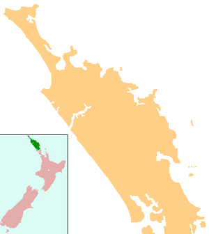
Purua is a locality north west of Whangarei in Northland, New Zealand. A hill also called Purua with a summit 387 m above sea level lies to the east.[1][2] The area mainly consists of rolling hills and river flats. Farming is Dairy, Sheep and Beef. The local hall is one of the notable buildings.
Purua | |
|---|---|
 Purua | |
| Coordinates: 35°37′56″S 174°06′26″E | |
| Country | New Zealand |
| Region | Northland Region |
| District | Whangarei District |
Education
Purua School is a coeducational full primary (years 1-8) school[3] with a roll of 24 as of March 2020.[4]
Notes
- Peter Dowling (editor) (2004). Reed New Zealand Atlas. Reed Books. pp. map 7. ISBN 0-7900-0952-8.CS1 maint: extra text: authors list (link)
- Roger Smith, GeographX (2005). The Geographic Atlas of New Zealand. Robbie Burton. pp. map 24. ISBN 1-877333-20-4.
- Education Counts: Purua School
- "New Zealand Schools Directory". New Zealand Ministry of Education. Retrieved 26 April 2020.
gollark: And how do I get *that* to work.
gollark: Wonderful. We need to just assume everyone has a C compiler installed.
gollark: https://wiki.haskell.org/Haskell_logos/New_logo_ideas
gollark: https://wiki.haskell.org/wikiupload/f/f3/UnsafeHaskell.png
gollark: It would compile *very* fast if it just smashed together the code and a C compiler.
This article is issued from Wikipedia. The text is licensed under Creative Commons - Attribution - Sharealike. Additional terms may apply for the media files.