Puerto Rico Highway 633
Puerto Rico Highway 633 (PR-633) is an east–west rural road located between the municipalities of Ciales and Morovis, Puerto Rico.[3] It begins at its intersection with PR-149[4] in Hato Viejo barrio and ends at its junction with PR-155[5] in Barahona.[6]
| ||||
|---|---|---|---|---|
| Route information | ||||
| Maintained by Puerto Rico DTPW | ||||
| Length | 4.3 km[1] (2.7 mi) | |||
| Existed | 1953[2]–present | |||
| Major junctions | ||||
| West end | ||||
| East end | ||||
| Location | ||||
| Municipalities | Ciales, Morovis | |||
| Highway system | ||||
| ||||

Major intersections
| Municipality | Location | km[1] | mi | Destinations | Notes |
|---|---|---|---|---|---|
| Ciales | Hato Viejo | 0.0 | 0.0 | Western terminus of PR-633 | |
| Morovis | Barahona | 4.3 | 2.7 | Eastern terminus of PR-633 | |
| 1.000 mi = 1.609 km; 1.000 km = 0.621 mi | |||||
Gallery for PR-633
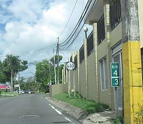 Puerto Rico Highway 633 in Barahona, Morovis
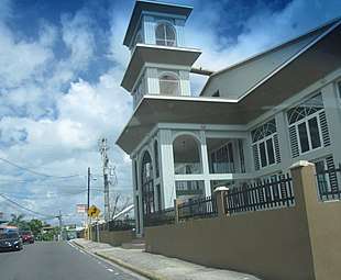 Building on Puerto Rico Highway 633 in Barahona, Morovis
Related route
| |
|---|---|
| Location | Ciales |
| Length | 0.22 km[7] (0.14 mi) |
Puerto Rico Highway 6633 (PR-6633) is a spur route located in Ciales. It extends from PR-6685 to PR-149, near to PR-633.[8] The entire route is located in Hato Viejo, Ciales.
| km[7] | mi | Destinations | Notes | ||
|---|---|---|---|---|---|
| 0.00 | 0.00 | Western terminus of PR-6633 | |||
| 0.22 | 0.14 | Eastern terminus of PR-6633 | |||
| 1.000 mi = 1.609 km; 1.000 km = 0.621 mi | |||||
gollark: Isn't it just 10 times the regular cooler or whatever, so 1200?
gollark: Or 80 ticks (4 seconds). Who knows, really.
gollark: https://github.com/turbodiesel4598/NuclearCraft/blob/a39b2178a164eacbdfa8d94c18180e5e31688c14/src/main/java/nc/tile/fluid/TileActiveCooler.java
gollark: Okay, if I wildly guessed at what the code does correctly, they store 80 seconds worth.
gollark: I *think* coolers store enough liquid for probably at least a minute of operation.
See also
References
- Google (28 February 2020). "PR-633" (Map). Google Maps. Google. Retrieved 28 February 2020.
- "Morovis, Memoria Núm. 65" (PDF). Puerto Rico Planning Board (in Spanish). 1955. Retrieved 22 February 2020.
- Puerto Rico (fold out) (Map). National Geographic Adventure Map (Book 3107). 7 May 2011. ISBN 978-1566955188.
- "PR-633, Ciales, Puerto Rico". geoview.info. Retrieved 22 February 2020.
- "PR-633, Morovis, Puerto Rico". geoview.info. Retrieved 22 February 2020.
- "Tránsito Promedio Diario (AADT)". Transit Data (Datos de Transito) (in Spanish). DTOP PR. p. 117.
- Google (22 March 2020). "PR-6633" (Map). Google Maps. Google. Retrieved 22 March 2020.
- "PR-6633, Ciales, Puerto Rico". geoview.info. Retrieved 22 March 2020.
External links
| Wikimedia Commons has media related to |
This article is issued from Wikipedia. The text is licensed under Creative Commons - Attribution - Sharealike. Additional terms may apply for the media files.