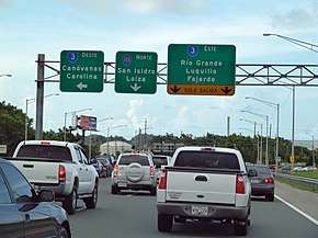
Puerto Rico Highway 188
Puerto Rico Highway 188 (PR-188) is a north–south highway that travels from Canóvanas, Puerto Rico to Loíza.[2] It begins at its intersection with PR-66 in Canóvanas and ends at its junction with PR-187 near downtown Loíza.[3]
| ||||
|---|---|---|---|---|
| Route information | ||||
| Maintained by Puerto Rico DTPW | ||||
| Length | 5.8 km[1] (3.6 mi) | |||
| Major junctions | ||||
| South end | ||||
| North end | ||||
| Location | ||||
| Municipalities | Canóvanas, Loíza | |||
| Highway system | ||||
| ||||
Major intersections

Puerto Rico Highway 3 and Puerto Rico Highway 188
| Municipality | Location | km[1] | mi | Destinations | Notes |
|---|---|---|---|---|---|
| Canóvanas | Canóvanas | 0.0 | 0.0 | Southern terminus of PR-188 | |
| Loíza | Loíza barrio-pueblo | 5.8 | 3.6 | Eastern terminus of PR-188 | |
| 1.000 mi = 1.609 km; 1.000 km = 0.621 mi | |||||
gollark: Idea: kernel space yes module for improved performance.
gollark: Sadly my phone CPU is weak and it can only do yes at 500MB/s.
gollark: What are you doing with it?
gollark: When have you needed that?
gollark: It is, because nobody actually needs to print `y\n` at 120GB/s. In fact, you're not even PRINTING it, just... counting and devnulling it.
See also
References
- Google (2 March 2020). "PR-188" (Map). Google Maps. Google. Retrieved 2 March 2020.
- National Geographic Maps (2011). Puerto Rico (Map). 1:125,000. Adventure Map. Evergreen, CO: National Geographic Maps. ISBN 978-1566955188. OCLC 756511572.
- "Tránsito Promedio Diario (AADT)". Transit Data (Datos de Transito) (in Spanish). DTOP PR. p. 100.
This article is issued from Wikipedia. The text is licensed under Creative Commons - Attribution - Sharealike. Additional terms may apply for the media files.
