Puerto Rico Highway 137
Puerto Rico Highway 137 (PR-137) is a north–south road that travels from Vega Baja to Morovis.[3] This highway extends from PR-2 in Vega Baja to PR-155 near downtown Morovis[4] and it is known as Expreso Ángel A. "Tony" Laureano Martínez.[1]
| ||||
|---|---|---|---|---|
| Expreso Ángel A. "Tony" Laureano Martínez[1] | ||||
| Route information | ||||
| Maintained by Puerto Rico DTPW | ||||
| Length | 17.9 km[2] (11.1 mi) | |||
| Major junctions | ||||
| South end | ||||
| ||||
| North end | ||||
| Location | ||||
| Municipalities | Morovis, Vega Baja | |||
| Highway system | ||||
| ||||
Veterans Cemetery
A new Puerto Rico National Cemetery for veterans is being built in Morovis, at a 247.5-acre parcel of land that can be accessed from Highway 137 at km 11.2. It is being built to replace the existing Puerto Rico National Cemetery located in Bayamón.[5][6]
Major intersections
| Municipality | Location | km[2] | mi | Destinations | Notes |
|---|---|---|---|---|---|
| Morovis | Morovis Norte | 17.9 | 11.1 | Southern terminus of PR-137 | |
| Monte Llano | 17.7 | 11.0 | |||
| 17.4 | 10.8 | ||||
| 17.1 | 10.6 | ||||
| Morovis Sud | 15.9 | 9.9 | |||
| Morovis Sud–Morovis Norte line | 15.2 | 9.4 | |||
| Morovis Norte | 12.6 | 7.8 | |||
| Fránquez | 12.0 | 7.5 | |||
| 9.3 | 5.8 | ||||
| 8.7 | 5.4 | Southern terminus of PR-155 concurrency | |||
| Barahona | 8.5 | 5.3 | Northern terminus of PR-155 concurrency | ||
| Vega Baja | Pugnado Adentro | 6.6 | 4.1 | ||
| Pugnado Afuera | 3.1 | 1.9 | |||
| Pugnado Afuera–Algarrobo line | 1.3– 1.2 | 0.81– 0.75 | |||
| Algarrobo | 0.7– 0.2 | 0.43– 0.12 | PR-22 exits 42, 42A and 42B; partial cloverleaf interchange | ||
| 0.0 | 0.0 | Northern terminus of PR-137 | |||
1.000 mi = 1.609 km; 1.000 km = 0.621 mi
| |||||
Gallery
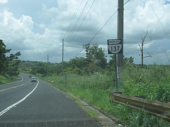
 PR-137 with shield in the shape of the island of Puerto Rico
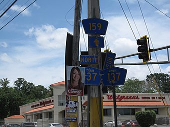
 PR-137 in Morovis
gollark: Yes; it's useless.
gollark: New LavaCuboids are now available from GTech at 2KST/i. They're just like real lava, but don't actually flow, and can be walked through without burning you.
gollark: Will buy a nether star + a few iron blocks for shulker shells.
gollark: Impressive.
gollark: The stairway is currently down for maintenance.
See also
References
- "Ley Núm. 435 del año 2000 Para designar un tramo de la carretera 137 de Morovis, con el nombre de Angel A. Laureano Martínez". LexJuris (Leyes y Jurisprudencia) de Puerto Rico (in Spanish). Retrieved 9 May 2019.
- Google (2 March 2020). "PR-137" (Map). Google Maps. Google. Retrieved 2 March 2020.
- National Geographic Maps (2011). Puerto Rico (Map). 1:125,000. Adventure Map. Evergreen, CO: National Geographic Maps. ISBN 978-1566955188. OCLC 756511572.
- "Tránsito Promedio Diario (AADT)". Puerto Rico Department of Transportation and Public Works (in Spanish). p. 76. Retrieved 9 May 2019.
- "Puerto Rico National Cemetery Replacement Morovis, Puerto Rico" (PDF). U.S. Dept. of Veterans Affairs. U.S. Dept. of Veterans Affairs.
- "A claim for better health services". El Nuevo Dia. 28 May 2019. Retrieved 13 June 2019.
This article is issued from Wikipedia. The text is licensed under Creative Commons - Attribution - Sharealike. Additional terms may apply for the media files.
