Puerto Rico Highway 130
Puerto Rico Highway 130 (PR-130) is the main north–south route within the municipality of Hatillo, Puerto Rico.[4]
| ||||
|---|---|---|---|---|
| Carretera Estatal Carlos Romero Barceló[1] | ||||
| Route information | ||||
| Maintained by Puerto Rico DTPW | ||||
| Length | 12.1 km[2] (7.5 mi) | |||
| Existed | 1953[3]–present | |||
| Major junctions | ||||
| South end | ||||
| ||||
| North end | ||||
| Location | ||||
| Municipalities | Hatillo | |||
| Highway system | ||||
| ||||

The highway starts from the downtown area (from PR-119), crossing the neighborhoods of Capáez, Naranjito, Buena Vista and Campo Alegre until it ends at Carretera Mariana Bracetti (PR-129).[5] In downtown, the highway runs through Calle Luis H. Lacomba and Avenida Pablo J. Aguilar until it crosses PR-2 in a southerly direction. This route is part of the caravan of the Hatillo Mask Festival.
Major intersections
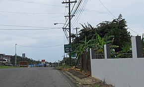
PR-488 and PR-130 junction in Hatillo
The entire route is located in Hatillo.
| Location | km[2] | mi | Destinations | Notes | |
|---|---|---|---|---|---|
| Campo Alegre | 12.1 | 7.5 | Southern terminus of PR-130 | ||
| Buena Vista–Naranjito– Campo Alegre–Corcovado quadripoint | 8.7 | 5.4 | |||
| Buena Vista–Naranjito line | 8.0 | 5.0 | |||
| Naranjito | 6.2 | 3.9 | |||
| Naranjito–Capáez line | 5.0 | 3.1 | |||
| Hatillo barrio-pueblo | 0.5 | 0.31 | |||
| 0.0 | 0.0 | Northern terminus of PR-130 | |||
| 1.000 mi = 1.609 km; 1.000 km = 0.621 mi | |||||
gollark: *pokes the abstract concept of poking*
gollark: https://devnull-as-a-service.com/
gollark: It can only do I think 32 or 22Gbps PCIe plus some DisplayPort.
gollark: Interestingly, the 40Gbps figure is for the actual link between the Thunderbolt controller and CPU.
gollark: Will they actually set up the link automatically for file transfer? I'm pretty sure Thunderbolt is just PCIe/DisplayPort over a cable.
See also
References
- "Pueden pasarle por encima a Romero Barceló - NOTICEL". NotiCel - La verdad como es - Noticias de Puerto Rico - NOTICEL (in Spanish). Retrieved 10 April 2019.
- Google (2 March 2020). "PR-130" (Map). Google Maps. Google. Retrieved 2 March 2020.
- "Hatillo, Memoria Núm. 63" (PDF). Puerto Rico Planning Board (in Spanish). 1954. Retrieved 4 August 2020.
- National Geographic Maps (2011). Puerto Rico (Map). 1:125,000. Adventure Map. Evergreen, CO: National Geographic Maps. ISBN 978-1566955188. OCLC 756511572.
- Puerto Rico Department of Transportation and Public Works. "Datos de Transito 2000-2009" (in Spanish). Retrieved 24 March 2019.
This article is issued from Wikipedia. The text is licensed under Creative Commons - Attribution - Sharealike. Additional terms may apply for the media files.