Puerto Rico Highway 115
Puerto Rico Highway 115 (PR-115) is a highway which follows the west coastline of Puerto Rico from south Añasco at PR-2 to near downtown Aguadilla, where it becomes Puerto Rico Highway 111 after intersecting PR-2 again[3] and is the primary route to the town of Rincón, Puerto Rico,[4] a tourist and frequent destination of surfers. As it enters Rincón, PR-115 becomes a divided highway with one lane per direction, with the median filled with trees, similar to some of the medians found in freeways in the United States. But PR-115 is not a freeway; it is a rural highway mostly one lane per direction. It enters toward downtown Rincón. The highway is subject to severe flooding when it rains.
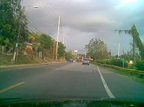
PR-115 in Aguada
| ||||
|---|---|---|---|---|
| Avenida Profesor Tomás Bonilla Feliciano[1] | ||||
| Route information | ||||
| Maintained by Puerto Rico DTPW | ||||
| Length | 27.8 km[2] (17.3 mi) | |||
| Major junctions | ||||
| South end | ||||
| ||||
| North end | ||||
| Location | ||||
| Municipalities | Añasco, Rincón, Aguada, Aguadilla | |||
| Highway system | ||||
| ||||


Major intersections
| Municipality | Location | km[2] | mi | Destinations | Notes |
|---|---|---|---|---|---|
| Añasco | Añasco Abajo | 0.0 | 0.0 | Southern terminus of PR-115 | |
| Hatillo | 3.3 | 2.1 | |||
| 4.3 | 2.7 | ||||
| Caguabo | 6.9 | 4.3 | |||
| Rincón | Calvache | 8.7 | 5.4 | ||
| 10.3 | 6.4 | ||||
| Rincón barrio-pueblo | 13.2 | 8.2 | One-way street | ||
| 13.3– 13.4 | 8.3– 8.3 | ||||
| 13.6 | 8.5 | ||||
| Río Grande | 15.4 | 9.6 | |||
| 17.2 | 10.7 | ||||
| Aguada | Guayabo | 20.4 | 12.7 | ||
| Guaniquilla–Guayabo line | 21.8 | 13.5 | Avenida Nativo Alers – Aguada | ||
| 22.6– 22.7 | 14.0– 14.1 | PR-441 access via Calle Jiménez | |||
| Aguada barrio-pueblo | 23.2– 23.3 | 14.4– 14.5 | One-way street | ||
| Asomante | 24.6 | 15.3 | |||
| 25.9 | 16.1 | ||||
| Carrizal | 26.8 | 16.7 | |||
| Río Culebrinas | 26.8– 26.9 | 16.7– 16.7 | Puente Conde de Caspe[5] | ||
| Espinar | 27.1 | 16.8 | |||
| Aguadilla | Victoria | 27.8 | 17.3 | Northern terminus of PR-115 | |
| 1.000 mi = 1.609 km; 1.000 km = 0.621 mi | |||||
gollark: I'm limited to whatever I can do with online editor tools and imagemagick.
gollark: No.
gollark: How about I add a white background to the transistor picture?
gollark: Are you sure white is a good idea? Electronic symbols are typically done as black.
gollark: It should accept SVGs, they are good.
See also
References
- "Para designar la Carretera Estatal PR-115 como "Avenida Profesor Tomás Bonilla Feliciano"". LexJuris (Leyes y Jurisprudencia) de Puerto Rico (in Spanish). 2018. Retrieved 1 June 2019.
- Google (11 March 2020). "PR-115" (Map). Google Maps. Google. Retrieved 11 March 2020.
- National Geographic Maps (2011). Puerto Rico (Map). 1:125,000. Adventure Map. Evergreen, CO: National Geographic Maps. ISBN 978-1566955188. OCLC 756511572.
- "Tránsito Promedio Diario (AADT)". Transit Data (in Spanish). DTOP PR. p. 65.
- Luis F. Pumarada O’Neill (1991). "Los Puentes Históricos de Puerto Rico" (PDF) (in Spanish). p. 114. Retrieved 11 March 2020.
This article is issued from Wikipedia. The text is licensed under Creative Commons - Attribution - Sharealike. Additional terms may apply for the media files.