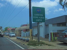
Puerto Rico Highway 107
Puerto Rico Highway 107 (PR-107), or Carretera Pedro Albizu Campos,[2] is a north–south highway located in Aguadilla, Puerto Rico.[3][4] It extends from PR-2 to Ramey Air Force Base.[5]
| ||||
|---|---|---|---|---|
| Carretera Pedro Albizu Campos | ||||
| Route information | ||||
| Maintained by Puerto Rico DTPW | ||||
| Length | 4.5 km[1] (2.8 mi) | |||
| Major junctions | ||||
| South end | ||||
| North end | Borinquen Road in Camaceyes–Borinquen | |||
| Location | ||||
| Municipalities | Aguadilla | |||
| Highway system | ||||
| ||||
Major intersections

Puerto Rico Highway 107

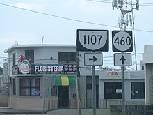
PR-460 and PR-1107 signs near Crash Boat Beach in Aguadilla
The entire route is located in Aguadilla.
| Location | km[1] | mi | Destinations | Notes | |
|---|---|---|---|---|---|
| Caimital Bajo | 0.0 | 0.0 | Southern terminus of PR-107 | ||
| Caimital Bajo–Camaceyes line | 0.1– 0.2 | 0.062– 0.12 | |||
| Camaceyes–Borinquen line | 0.5– 0.6 | 0.31– 0.37 | |||
| Borinquen | 0.9 | 0.56 | |||
| 1.9– 2.0 | 1.2– 1.2 | ||||
| Camaceyes–Borinquen line | 4.1 | 2.5 | |||
| 4.5 | 2.8 | Borinquen Road – Ramey Air Force Base | Northern terminus of PR-107 | ||
1.000 mi = 1.609 km; 1.000 km = 0.621 mi
| |||||
gollark: Large-scale politics is *basically* (EDIT: mostly) a horrible infohazard pushed by organizations trying to maximize your engagement (which is often done by generating outrage at the Other Side) and the politicians trying to get you to use your small and indirected power to benefit them.
gollark: NOT ignoring them doesn't work well either.
gollark: I mean, local ones maybe not, you can actually affect those.
gollark: Yes, do so.
gollark: You have basically ~0 influence on it and it tends to kill sanity!
See also
References
- Google (2 March 2020). "PR-107" (Map). Google Maps. Google. Retrieved 2 March 2020.
- "Av. Dr. Pedro Albizu Campos & PR-107". Google maps.
- National Geographic Maps (2011). Puerto Rico (Map). 1:125,000. Adventure Map. Evergreen, CO: National Geographic Maps. ISBN 978-1566955188. OCLC 756511572.
- "Listado NHS2008(Muestras).xls" (PDF). DTOP gov't of P.R. 5 November 2010.
- "Tránsito Promedio Diario (AADT)". Transit Data (Datos de Transito) (in Spanish). DTOP PR. p. 58.
This article is issued from Wikipedia. The text is licensed under Creative Commons - Attribution - Sharealike. Additional terms may apply for the media files.

