Pragpur
Pragpur is a village situated in Kangra district of Himachal Pradesh. Lying in the shadows of Dhauladhar range, and developed about 3 centuries ago, the village of Pragpur along with the nearby village of Garli, is notified as a "Heritage Village" by a State Government notification dated 9 December 1997. As per the constitution of India and Panchyati Raaj Act, Pragpur village is administrated by the sarpanch, who is the elected representative of the village.[1]
Pragpur | |
|---|---|
Village | |
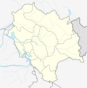
 Pragpur Location in Himachal Pradesh, India  Pragpur Pragpur (India) | |
| Coordinates: 31.67°N 76.07°E | |
| Country | |
| State | Himachal Pradesh |
| District | Kangra |
| Elevation | 650 m (2,130 ft) |
| Population (2011) | |
| • Total | 502 |
| Languages | |
| • Official | Hindi, Pahari |
| Time zone | UTC+5:30 (IST) |
History
Pragpur was founded in the late 16th century by the Patials in memory of Princess Prag Dei of the Jaswan Royal family. The area of Pragpur was part of the principality of Jaswan whose chief, in the late 16th or early 17th century, charged a band of learned men, led by a Kuthiala Sood, to find a suitable place to commemorate Princess 'Prag' of his royal lineage.[2]
Pragpur is an ornamental village with unchanged shops, cobblestone streets, old water tanks, mud-plastered walls and slate-roofed houses. The narrow streets, lined with fort-like houses, havelis and villas, are indicative of the area's aged charisma. Due to its unique architecture and pristine beauty, the state government of Himachal Pradesh declared Pragpur as the country's first Heritage Village in December 1997.
Prag means "pollen" in Sanskrit and pur means "full of", so Prag-pur means "full of pollen", which rightly describes the area when it is ablaze with blossoms in spring.
Along with Pragpur, the nearby village of Garli is a part of the Heritage Zone. The Judges Court is a resort built in a typical Anglo-Indian style of architecture. It stands in 12 acres of greens, and is just a short walk from the village core and the Taal. Apart from the Judges Court, which was built in 1918, Mr Lal has restored his 300-year-old ancestral house.[3]
Places of interest
The places of interest within the Heritage Village Pragpur are the Lala Rerumal Haveli built in 1931 by a Rais of Pragpur, which has a Mughal style garden, pleasure terrace and a large water reservoir. Butail Mandir, Chaujjar Mansion, courtyards of the Sood Clans, an ancient Shakti Mandir and atiyalas or public platforms are the pride of this heritage village. There are many silversmiths in the market selling traditional trinkets and curios. The village is known for its cottage industry. The inhabitants in the area are mostly craftspeople, weavers, basket makers, silversmiths, painters, musicians and tailors. One can purchase hand-woven blankets, shawls and hand-block printed clothes.[4]
- Dehra: a small town situated near Pragpur
- Sidh Chanu Temple: a famous pilgrimage place in Pragpur
- Chhinmastika Dham: also known as Chintapurani Mata Mandir; a famous religious place; 27 km from Pragpur
- Jwalaji Mata: this temple is a famous religious place, 23 km from Pragpur
- Nearby markets: Garli, Dhalihara, Neharan Pukhar[5]
Climate
- Spring: about mid-February to mid-April; the winter starts losing its bite around mid-February
- Summer: mid-April to end of June; it is hot in summer and light cottons are recommended
- Rainy season: July to September; still quite warm and humid; lots of rain
- Autumn: October to November; days are pleasantly warm; nights are cool; one may need light woollens at night or early mornings
- Winter: December-January; it is quite pleasant during the day and one may get by with one layer of woollens; the winter nights are cold and an extra layer of woolens is required.
| Climate data for Pragpur | |||||||||||||
|---|---|---|---|---|---|---|---|---|---|---|---|---|---|
| Month | Jan | Feb | Mar | Apr | May | Jun | Jul | Aug | Sep | Oct | Nov | Dec | Year |
| Average high °C (°F) | 17.9 (64.2) |
21.1 (70.0) |
26.0 (78.8) |
32.0 (89.6) |
37.0 (98.6) |
36.8 (98.2) |
32.2 (90.0) |
30.8 (87.4) |
31.1 (88.0) |
28.8 (83.8) |
25.3 (77.5) |
18.1 (64.6) |
28.1 (82.6) |
| Average low °C (°F) | 4.1 (39.4) |
6.3 (43.3) |
13.4 (56.1) |
17.5 (63.5) |
22.2 (72.0) |
24.4 (75.9) |
24.0 (75.2) |
18.3 (64.9) |
17.8 (64.0) |
11.0 (51.8) |
09.5 (49.1) |
5.0 (41.0) |
14.5 (58.0) |
| Source: World Meteorological Organisation[6] | |||||||||||||
Transport
Pragpur is well connected by air, rail and road. Gaggal is the nearest airport, around 55 km away. Pathankot is another airport, about 100 km away.
By train, it is connected by the narrow gauge Kangra Railway, that starts at Pathankot.
Nearest rail hubs are Guler or Jwalamukhi, both about 20 km away.
By bus, it is 6 km from Kalhoa on National Highway 70, connecting Amb to Hamirpur.
Pragpur is well connected with all the advance communication networks. BSNL and all other network companies have their network here. Nationalize banks, India post have their branches here. Many local administrative offices also situated here.
References
- "Prgapur time traveling in Himachal".
- "Pragpur a Himalayan tryst with history".
- "Judge Court Pragpur".
- "Pragpur first heritage village of India".
- "Native place of pragpur".
- World Weather Information Service-Chandigarh, World Meteorological Organisation. Retrieved 29 September 2012.