Pont Cych
Pont Cych is a single-arch, Grade II-listed bridge over Afon Cych at Cwmcych in the Cych Valley, bordering Carmarthenshire and Pembrokeshire, Wales.
Pont Cych | |
|---|---|
Pont Cych from upstream | |
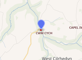
| Coordinates | 51.9971°N 4.5136°W |
| Carries | Unclassified lane |
| Crosses | Afon Cych |
| Locale | Cwmcych, West Wales |
| Heritage status | Grade II |
| Characteristics | |
| Design | Arch bridge |
| History | |
| Construction end | 1737 |

| |

History
The bridge was rebuilt in 1737 (indicating an earlier bridge existed) and probably rebuilt in the 19th century.
The CADW citation says:
Rubble stone single arch bridge with stone voussoirs to arch rings and projecting flat string course over the arch. Ramped rubble stone parapet and rubble stone abutments each side. Datestone reads 'This bridge rebuilt by both counties. Is Harries, H Howells, overseers. MDCCXXXVII'.[1]
It was listed as the best example of the several bridges over Afon Cych. It carries a minor road that leads to the village of Llanfyrnach from the Cych valley.[1]
The bridge, opposite the former Fox and Hounds inn, was a meeting place for the Tivyside Hounds for fox hunting in the late 19th century.[2][3]
The north parapet of the bridge carries an Ordnance Survey cut mark, marking a point 46.47 metres (152.5 ft) above mean sea level.[4]
There is a recently-working hydro-power installation at the bridge, according to the British Hydropower Association's 2014 map of the UK.[5] In 2017, it caused some concern from Natural Resources Wales in respect of its construction design.[6]
References
- Cadw. "Pont Cych (Grade II) (14243)". National Historic Assets of Wales. Retrieved 29 July 2019.
- "Hunting appointments". Potters Electric News. British Newspaper Archive. 27 November 1867. Retrieved 20 March 2016.
- "Hunting appointments". Pall Mall Gazette. British Newspaper Archive. 21 March 1874. Retrieved 20 March 2016.
- "Geograph: SN2736: Ordnance Survey Cut Mark". Retrieved 19 June 2020.
- "BHA: Hydropower installations 2014" (PDF). Retrieved 19 June 2020.
- "Natural Resources Wales: Lamprey Assessment" (PDF). p. 20. Retrieved 19 June 2020.