Podvis Col
Podvis Col (Bulgarian: седловина Подвис, ‘Sedlovina Podvis’ \se-dlo-vi-'na 'pod-vis\) is the ice-covered col of elevation 1494 m on Davis Coast in Graham Land, Antarctica, extending 1.6 km between Korten Ridge to the northwest, and Tsarevets Buttress and Detroit Plateau to the southeast. It is overlooking Sabine Glacier to the north and Temple Glacier to the southwest.
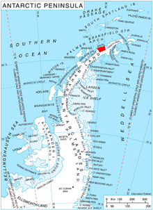
Location of Davis Coast.
The col is named after the settlement of Podvis in Southeastern Bulgaria.
Location
Podvis Col is centred at 63°58′51″S 59°46′39″W. German-British mapping in 1996.
Map
- Trinity Peninsula. Scale 1:250000 topographic map No. 5697. Institut für Angewandte Geodäsie and British Antarctic Survey, 1996.
gollark: Not even osmarks.tk is probably maybe.
gollark: I doubt they're vulnerable to obvious XSS ættacks.
gollark: And yet people apparently enjoy that sort of thing for unfathomable reasons, so you're wrong.
gollark: What about jellycutting?
gollark: Technically, space elves MAY just be mind-controlling you into belief in nonsense concepts like "light" and "clocks".
References
- SCAR Composite Antarctic Gazetteer.
- Bulgarian Antarctic Gazetteer. Antarctic Place-names Commission. (details in Bulgarian, basic data in English)
External links
- Podvis Col. Copernix satellite image
This article includes information from the Antarctic Place-names Commission of Bulgaria which is used with permission.
This article is issued from Wikipedia. The text is licensed under Creative Commons - Attribution - Sharealike. Additional terms may apply for the media files.