Plummer Peak
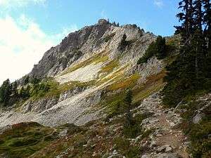
Plummer Peak is a summit located in Mount Rainier National Park in Lewis County, Washington. With an elevation of 6,374 feet (1,943 m)[1] it is the seventh highest peak in the Tatoosh Range. It was named for Fred G. Plummer, a Forest Service cartographer who taught geography in Tacoma Public Schools.[2] [3]
| Plummer Peak | |
|---|---|
 Plummer Peak | |
| Highest point | |
| Elevation | 6,374 ft (1,943 m) [1] NAVD 88 |
| Prominence | 410 ft (125 m) [1] |
| Coordinates | 46°45′12″N 121°44′22″W [1] |
| Geography | |
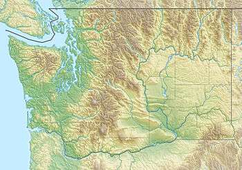
 Plummer Peak Mount Rainier National Park, Washington, U.S. | |
| Parent range | Cascades, Tatoosh Range |
| Topo map | USGS Mount Rainier East |
Hiking to the summit requires a mix of hillwalking and scrambling.[4] The area is also used for skiing,[5] though avalanches present a danger; in 1988, skier Pamela Benton Lee died after being buried by an avalanche on Plummer Peak.[6]
From the peak, views of Mount Rainier, the town of Packwood, the Goat Rocks, Mount St. Helens, and Mount Adams are visible.[7] A small tarn is located on the side of the summit.[7] A col called "The Saddle" creates a walkable ridge connecting Plummer Peak to its neighbor, Pinnacle Peak.[8]
References
- "Plummer Peak." Peakbagger.com. Accessed on July 18, 2011.
- "Origins of Landmark Names". Tacoma News Tribune. Archived from the original on 2012-09-08. Retrieved 2011-07-18.
- Reese, Gary Fuller (1989). Origins of Pierce County Place Names. R&M Press.
- "Plummer Peak". Peakware.com. Archived from the original on 2016-03-04. Retrieved 2011-07-18.
- Nelson, Jim; Potterfield, Peter (2000). Climbs in the Cascades: Alpine routes, sport climbs & crag climbs. The Mountaineers Books. Retrieved 2011-07-18.
- "Searchers Find Body of Buried Skier". Ocala Star-Banner. 1988-03-08. Retrieved 2011-07-18.
- "Pinnacle Saddle / Plummer Peak". Visit Rainier. Retrieved 2011-07-18.
- Sykes, Karen (2004-08-04). "Here's one trek suitable for those hot days". Hike Of The Week. Seattle Post-Intelligencer. Retrieved 2011-07-19.