Pipiwai
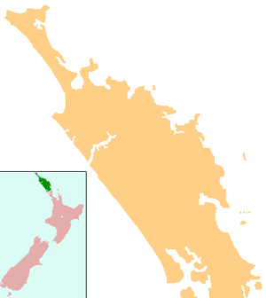
Pipiwai or Pīpīwai is a locality in the Te Horo valley in Northland, New Zealand. Whangarei is about 35 km to the southeast. Titoki is about 16 km to the south.[1][2]
Pipiwai | |
|---|---|
 Pipiwai | |
| Coordinates: 35°37′14″S 174°01′07″E | |
| Country | New Zealand |
| Region | Northland Region |
| District | Whangarei District |
There are few jobs in the area, and most adults are either on benefits or commute to Whangarei or Dargaville.[3]
Marae
The local Tau Henare Marae and meeting house are a traditional meeting ground for the Ngāpuhi hapū of Te Orewai and Ngāti Hine. The Omauri marae grounds, located near Pipiwai, are a meeting place for the Ngāpuhi hapū of Ngā Uri o Puhatahi.[4][5]
Education
Te Horo School is a coeducational full primary (years 1-8) school with a decile rating of 2 and a roll of 38.[6]
Tau Henare Marae runs a kohanga reo.[3]
Notable people
- Taurekareka Henare, Reform Party politician[7]
Notes
- Peter Dowling (editor) (2004). Reed New Zealand Atlas. Reed Books. pp. map 7. ISBN 0-7900-0952-8.CS1 maint: extra text: authors list (link)
- Roger Smith, GeographX (2005). The Geographic Atlas of New Zealand. Robbie Burton. pp. map 24. ISBN 1-877333-20-4.
- "Case Studies - Te Horo School, Northland". Rural Communities Trust. Archived from the original on 14 October 2008. Retrieved 9 May 2008.
- "Te Kāhui Māngai directory". tkm.govt.nz. Te Puni Kōkiri.
- "Māori Maps". maorimaps.com. Te Potiki National Trust.
- Education Counts: Te Horo School
- McConnell, Robin C. "Henare, Taurekareka 1877/1878? - 1940". Dictionary of New Zealand Biography. Ministry for Culture and Heritage. Retrieved 4 April 2011.
gollark: Actually, this is a good idea. You could view statistical statistics and press buttons.
gollark: Well, I could make a web interface for blattidus instances.
gollark: 2203.
gollark: Hi, bee.
gollark: Oops.
This article is issued from Wikipedia. The text is licensed under Creative Commons - Attribution - Sharealike. Additional terms may apply for the media files.