Pilot Hill
Pilot Hill is a hill in Hampshire, UK, which at 286 m (938 ft) has been the highest in the modern administrative county council area since border changes in 1895. However, it is not the historic county top of Hampshire, which is Walbury Hill, 297 metres (974 ft) high, which lies about 2 miles (3.2 km) to the northwest.
- For the place in California, see Pilot Hill, California.
| Pilot Hill | |
|---|---|
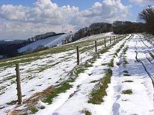 On the Wayfarer's Walk as it approaches Pilot Hill. | |
| Highest point | |
| Elevation | 286 m (938 ft) |
| Prominence | 45 m (148 ft) |
| Listing | County Top |
| Coordinates | 51°20′19″N 1°25′48″W |
| Geography | |
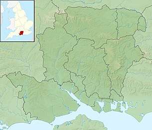 Pilot Hill Pilot Hill in Hampshire | |
| Location | North Downs, England |
| OS grid | SU398601 |
| Topo map | OS Landranger 174 |
The hill is about 7 miles (11 km) southwest of Newbury on the Hampshire/Berkshire border and is part of the north-facing scarp of the North Hampshire Downs, a chalk ridge within the North Wessex Downs Area of Outstanding Natural Beauty. The upper slopes are open calcareous grassland, while the lower slopes are wooded. The north face of the hill lies in West Berkshire.
This article is issued from Wikipedia. The text is licensed under Creative Commons - Attribution - Sharealike. Additional terms may apply for the media files.