Pike County Airport (Ohio)
Pike County Airport (ICAO: KEOP, FAA LID: EOP) is three miles northeast of Waverly, a village in Pike County, Ohio.[1] The FAA's National Plan of Integrated Airport Systems for 2011–2015 categorized it as a general aviation facility.[2]
Pike County Airport | |||||||||||
|---|---|---|---|---|---|---|---|---|---|---|---|
 Pike County Airport | |||||||||||
| Summary | |||||||||||
| Airport type | Public | ||||||||||
| Owner | Pike County Airport Authority | ||||||||||
| Serves | Pike County, Ohio | ||||||||||
| Location | Waverly, Ohio | ||||||||||
| Elevation AMSL | 660 ft / 201 m | ||||||||||
| Coordinates | 39°10′01″N 082°55′41″W | ||||||||||
| Website | Pike County Airport | ||||||||||
| Map | |||||||||||
 EOP  EOP | |||||||||||
| Runways | |||||||||||
| |||||||||||
| Statistics (2009) | |||||||||||
| |||||||||||
Many U.S. airports use the same three-letter location identifier for the FAA and IATA, but this facility is EOP to the FAA and has no IATA code.[3]
Facilities
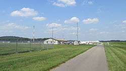
Pike County Airport covers 70 acres (28 ha) at an elevation of 660 feet (201 m). Its one runway, 7/25, is 4,900 by 75 feet (1,494 x 23 m).[1]
In the year ending June 30, 2009 the airport had 2,012 aircraft operations, average 167 per month: 99% general aviation and 1% military. Six single-engine aircraft were then based at the airport.[1]
gollark: A location.
gollark: Fine, I attain equipment.
gollark: Unless I can't.
gollark: There must be *some* way I can deal with the apiopyroforms, instead of not doing so.
gollark: Maybe it should not be, for purposes.
References
- FAA Airport Master Record for EOP (Form 5010 PDF). Federal Aviation Administration. Effective 30 June 2011.
- National Plan of Integrated Airport Systems for 2011–2015: Appendix A (PDF, 2.03 MB). Federal Aviation Administration. Updated 4 October 2010.
- "Pike County Airport (FAA: EOP, ICAO: KEOP)". Great Circle Mapper. Retrieved 2 July 2011.
External links
- PikeCountyAirport.wordpress.com
- Aerial photo as of 23 March 1994 from USGS The National Map
- FAA Terminal Procedures for EOP, effective August 13, 2020
- Resources for this airport:
- FAA airport information for EOP
- AirNav airport information for EOP
- FlightAware airport information and live flight tracker
- SkyVector aeronautical chart for EOP
This article is issued from Wikipedia. The text is licensed under Creative Commons - Attribution - Sharealike. Additional terms may apply for the media files.