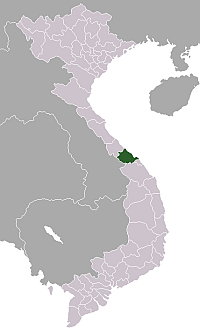
Phú Lộc, Thừa Thiên–Huế
Phú Lộc is a township (thị trấn) and capital of Phú Lộc District, Thừa Thiên–Huế Province.[1] The township is located in the middle between the cities of Huế and Da Nang, to the south of Tam Giang – Cầu Hai lagoon and at the foot of Bạch Mã National Park.
Phú Lộc Thị trấn Phú Lộc | |
|---|---|
| Phú Lộc township | |
| Coordinates: 16°16′N 107°53′E | |
| Country | |
| Region | North Central Coast |
| Province | Thừa Thiên–Huế |
| District | Phú Lộc District |
| Time zone | UTC+7 (UTC + 7) |
In 1968, few months before the Tết Offensive, the Cầu Hai bridge was blown up by the North Vietnamese Army and Viet Cong. The bridge was later rebuilt.
Over the Cầu Hai Bay is the My A village. My A was famous for her main route that goes across the village that has coconut trees planted from generations. Villagers fled to the United States during the communist rule.
References
- "Administrative subdivisions". To find information at reference, go to row 46, then row 482, and it is listed on row 20107: General Statistics Office of Vietnam.CS1 maint: location (link)
This article is issued from Wikipedia. The text is licensed under Creative Commons - Attribution - Sharealike. Additional terms may apply for the media files.