Pezuela
Pezuela is a barrio in the municipality of Lares, Puerto Rico. Its population in 2010 was 474.[3][4][5] The barrio is divided into about 8 sectors. The barrio has been prone to landslides since Hurricane Maria struck in 2017.
Pezuela Pesuela | |
|---|---|
Barrio | |
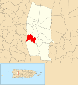 Location of Pezuela barrio within the municipality of Lares shown in red | |
 Pezuela Location of Puerto Rico | |
| Coordinates: 18°14′38″N 66°54′01″W[1] | |
| Commonwealth | |
| Municipality | |
| Area | |
| • Total | 2.42 sq mi (6.3 km2) |
| • Land | 2.42 sq mi (6.3 km2) |
| • Water | 0 sq mi (0 km2) |
| Elevation | 787 ft (240 m) |
| Population (2010) | |
| • Total | 474 |
| • Density | 195.9/sq mi (75.6/km2) |
| Source: 2010 Census | |
| Time zone | UTC−4 (AST) |
History
The United States took control of Puerto Rico from Spain in the aftermath of the Spanish-American War under the terms of the Treaty of Paris of 1898. In 1899, the United States conducted its first census of Puerto Rico finding that the population of Pezuela barrio was 1,010.[6]
In late 2019, 12 landslides occurred in one month's time as a result of heavy rainfall and some homes were in danger of collapsing near PR-131. Residents stated the problem was caused by years of inaction to correct and clear waterways after Hurricane Maria, which struck in 2017. The people fear that a large landslide could occur and cause many deaths as happened with the Mameyes Landslide in Portugués Urbano barrio in Ponce in 1985.[7]
Sectors
Barrios (which are like minor civil divisions)[8] in turn are further subdivided into smaller local populated place areas/units called sectores (sectors in English). The types of sectores may vary, from normally sector to urbanización to reparto to barriada to residencial, among others.[9][10][11]
The following sectors are in Pezuela barrio:[12]
Hacienda Marrero, Hacienda Rojas, Hacienda Vilella, La Vega de los Acevedo, Maguelles, Sector Ezenelías, Sector Sisco, and Tramo Carretera 431.
References
- "US Gazetteer 2019". US Census. US Government.
- U.S. Geological Survey Geographic Names Information System: Pezuela barrio
- Picó, Rafael; Buitrago de Santiago, Zayda; Berrios, Hector H. Nueva geografía de Puerto Rico: física, económica, y social, por Rafael Picó. Con la colaboración de Zayda Buitrago de Santiago y Héctor H. Berrios. San Juan Editorial Universitaria, Universidad de Puerto Rico,1969.
- Gwillim Law (20 May 2015). Administrative Subdivisions of Countries: A Comprehensive World Reference, 1900 through 1998. McFarland. p. 300. ISBN 978-1-4766-0447-3. Retrieved 25 December 2018.
- Puerto Rico:2010:population and housing unit counts.pdf (PDF). U.S. Dept. of Commerce, Economics and Statistics Administration, U.S. Census Bureau. 2010.
- Joseph Prentiss Sanger; Henry Gannett; Walter Francis Willcox (1900). Informe sobre el censo de Puerto Rico, 1899, United States. War Dept. Porto Rico Census Office (in Spanish). Imprenta del gobierno. p. 160.
- "Temen "segundo Mameyes" en Lares [They fear a "second Mameyes" in Lares]". Telemundo (in Spanish).
- "US Census Barrio-Pueblo definition". factfinder.com. US Census. Archived from the original on 13 May 2017. Retrieved 5 January 2019.
- "Agencia: Oficina del Coordinador General para el Financiamiento Socioeconómico y la Autogestión (Proposed 2016 Budget)". Puerto Rico Budgets (in Spanish). Retrieved 28 June 2019.
- Rivera Quintero, Marcia (2014), El vuelo de la esperanza: Proyecto de las Comunidades Especiales Puerto Rico, 1997-2004 (first ed.), San Juan, Puerto Rico Fundación Sila M. Calderón, ISBN 978-0-9820806-1-0
- "Leyes del 2001". Lex Juris Puerto Rico (in Spanish). Retrieved 24 June 2020.
- "PRECINTO ELECTORAL LARES 053" (PDF). Comisión Estatal de Elecciones (in Spanish). PR Government. 14 June 2019. Retrieved 19 June 2019.