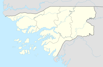
Pecixe
Pecixe is an island in Guinea-Bissau. It is a coastal island belonging to the Cacheu Region and the Caió sector. Its area is 167 km².[3] The island has a population of 3,207 (2009 census); the largest village is Cassaca.[2] The language of the island is reported to be Mandjak, a language of Guinea-Bissau with over 72,000 speakers altogether.[4] Jeta island lies to the west. It is 3 km off the mainland, about 50 km west of the capital city Bissau.
 Pecixe Location | |
| Geography | |
|---|---|
| Location | Atlantic Ocean |
| Coordinates | 11.8333°N 16.0833°W[1] |
| Area | 167 km2 (64 sq mi) |
| Highest elevation | 6 m (20 ft) |
| Administration | |
| Region | Cacheu Region |
| Sector | Caió |
| Demographics | |
| Population | 3,207 (2009)[2] |
Climate
Cassaga, the largest village on the island has a tropical savanna climate (Aw) with little to no rainfall from November to May and heavy to extremely heavy rainfall from June to October.
| Climate data for Cassaga | |||||||||||||
|---|---|---|---|---|---|---|---|---|---|---|---|---|---|
| Month | Jan | Feb | Mar | Apr | May | Jun | Jul | Aug | Sep | Oct | Nov | Dec | Year |
| Average high °C (°F) | 31.7 (89.1) |
33.3 (91.9) |
34.2 (93.6) |
34.2 (93.6) |
33.4 (92.1) |
31.7 (89.1) |
29.9 (85.8) |
29.1 (84.4) |
30.1 (86.2) |
31.5 (88.7) |
32.1 (89.8) |
31.2 (88.2) |
31.9 (89.4) |
| Daily mean °C (°F) | 24.4 (75.9) |
25.7 (78.3) |
26.7 (80.1) |
27.3 (81.1) |
27.7 (81.9) |
27.4 (81.3) |
26.5 (79.7) |
25.9 (78.6) |
26.4 (79.5) |
27.2 (81.0) |
26.9 (80.4) |
24.8 (76.6) |
26.4 (79.5) |
| Average low °C (°F) | 17.1 (62.8) |
18.1 (64.6) |
19.3 (66.7) |
20.5 (68.9) |
22.1 (71.8) |
23.1 (73.6) |
23.1 (73.6) |
22.8 (73.0) |
22.8 (73.0) |
22.9 (73.2) |
21.8 (71.2) |
18.5 (65.3) |
21.0 (69.8) |
| Average rainfall mm (inches) | 0 (0) |
0 (0) |
0 (0) |
0 (0) |
11 (0.4) |
151 (5.9) |
536 (21.1) |
673 (26.5) |
411 (16.2) |
192 (7.6) |
30 (1.2) |
3 (0.1) |
2,007 (79) |
| Source: Climate-Data.org[5] | |||||||||||||
gollark: Or, well, not ANYTHING, just stuff they can do.
gollark: > Certain game functions may be performed automatically by automated “bots”; the behavior of such bots is governed by themselves, and any function that bots may perform is allowed, including but not limited to the following:As you can see, this clause permits bots to do literally anything whatsoever, including deleting you.
gollark: I invoke rule 1.7 to declare you deleted.
gollark: No, the RULES™ determine the game state.
gollark: No you don't. The rules say you have zero votes, but contain a memetic hazard which makes viewers believe you get five.
See also
References
- Ilha de Pecixe - Mapcarta
- População por região, sector e localidades por sexo censo 2009, Instituto Nacional de Estatística Guiné-Bissau
- Pecixe in the Catalogue of Islands at UNEP (United Nations Environment Program) - accessed 16 November 2018
- Diedrich Westermann & Margaret Arminel Bryan, The Languages of West Africa International African Institute 1970.
- "Climate: Cassaga". Climate-Data.org. Retrieved August 6, 2020.
This article is issued from Wikipedia. The text is licensed under Creative Commons - Attribution - Sharealike. Additional terms may apply for the media files.