Peña Pobre
Peña Pobre is a barrio in the municipality of Naguabo, Puerto Rico. Its population in 2010 was 4,131.[3][4][5]
Peña Pobre | |
|---|---|
Barrio | |
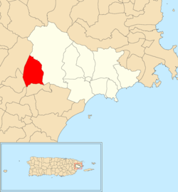 Location of Peña Pobre within the municipality of Naguabo shown in red | |
 Peña Pobre Location of Puerto Rico | |
| Coordinates: 18°13′13″N 65°48′55″W[1] | |
| Commonwealth | |
| Municipality | |
| Area | |
| • Total | 4.38 sq mi (11.3 km2) |
| • Land | 4.38 sq mi (11.3 km2) |
| • Water | 0 sq mi (0 km2) |
| Elevation | 413 ft (126 m) |
| Population (2010) | |
| • Total | 4,131 |
| • Density | 943.2/sq mi (364.2/km2) |
| Source: 2010 Census | |
| Time zone | UTC−4 (AST) |
Hurricane Maria
Peña Pobre was hit particularly bad by Hurricane Maria on September 19, 2017. Members of Jesucristo Monte Moriah, a local church, worked with World Central Kitchen and José Andrés to prepare meals. The infrastructure had been destroyed and Puerto Ricans were finding it very difficult to find ingredients for cooking, money for buying food, or gasoline to move around. This community is located up in the mountains accessed through steep, curvy roads which had lost their borders. The community worked to cook and deliver meals to families that could not feed themselves and their families.[6]
History
The United States took control of Puerto Rico from Spain in the aftermath of the Spanish-American War under the terms of the Treaty of Paris of 1898. In 1899, the United States conducted its first census of Puerto Rico finding that the population of Peña Pobre barrio was 1,064.[7]
See also
References
- "US Gazetteer 2019". US Census. US Government.
- U.S. Geological Survey Geographic Names Information System: Peña Pobre barrio
- Picó, Rafael; Buitrago de Santiago, Zayda; Berrios, Hector H. Nueva geografía de Puerto Rico: física, económica, y social, por Rafael Picó. Con la colaboración de Zayda Buitrago de Santiago y Héctor H. Berrios. San Juan Editorial Universitaria, Universidad de Puerto Rico,1969.
- Gwillim Law (20 May 2015). Administrative Subdivisions of Countries: A Comprehensive World Reference, 1900 through 1998. McFarland. p. 300. ISBN 978-1-4766-0447-3. Retrieved 25 December 2018.
- Puerto Rico:2010:population and housing unit counts.pdf (PDF). U.S. Dept. of Commerce, Economics and Statistics Administration, U.S. Census Bureau. 2010.
- Andrés, José (22 February 2018). "We Fed an Island: the True Story of Rebuilding Puerto Rico, One Meal at a Time". WorldCat. pp. 199–203.
- Joseph Prentiss Sanger; Henry Gannett; Walter Francis Willcox (1900). Informe sobre el censo de Puerto Rico, 1899, United States. War Dept. Porto Rico Census Office (in Spanish). Imprenta del gobierno. p. 163.