Parley's Trail
Parley's Trail is an east-west cycling and pedestrian multi-use pathway in eastern Salt Lake County, Utah, United States.
| |
|---|---|
| Major junctions | |
| East end | Bonneville Shoreline Trail |
| West end | Jordan River Parkway |
| Route Length | |
| Length | 8 mi (13 km) |
| Highway system | |
| |
Description
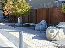
Parley's trail serves as a east-west multi-use pathway between the Bonneville Shoreline Trail and the Jordan River Parkway.[1] The trail parallels the S Line streetcar though the neighborhoods of South Salt Lake and Sugar House before running along Interstate 80. The trail is 8 miles long, 1.5 miles of which are on roads.
1.2 miles (1.9 km) of separation including bridge and tunnel work is actively being conducted by the Utah Department of Transportation with an expected finish of summer of 2017.[2] In gaps where the path isn't fully separated from cars, the trail has been temporarily routed on sidewalks and on-street bike lanes. Maps and updates on the project can be found on the Parley's Trail Alliance website.[3]
See also
- Parley's Canyon
- Cycling infrastructure
- Sugar House Park
References
- Boal, Jed (24 Sep 2010). "Parley's Trail reconnects neighborhoods". ksl.com. Deseret Digital Media. Retrieved 20 Jun 2019.
- "Parley's Trail: I-80 Corridor". parleystrail.squarespace.com. Retrieved 20 Jun 2019.
- "Parley's Trail: Trail Overview". parleystrail.squarespace.com. Retrieved 20 Jun 2019.
External links
![]()